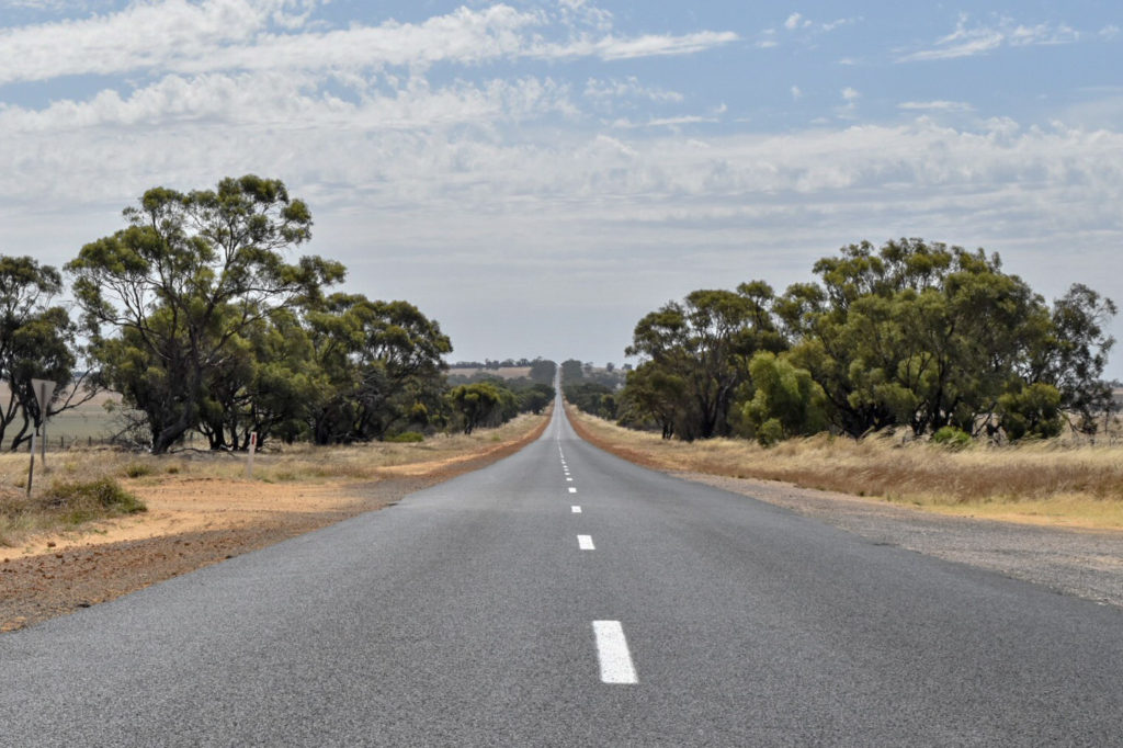
From the cracking start to our trip in the Grampians, we took off to Big Desert National Park via Horsham to run errands (turns out when you’re travelling in a van, life admin is still required). After a final stop through the town of Nhill for last minute supplies, we headed into the national park towards Broken Bucket campsite via Murrayville Track.
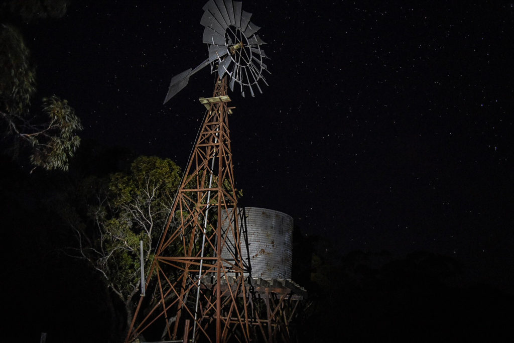
We were elated when we arrived to a large, empty campground to have our pick of sites. However, the excitement of finally having the remoteness that we were craving gradually changed to a slight uneasiness. “No people?! This is great!” slowly gave way to “What was that sound??” After spending over 8 years in the city, the pure isolation was a bit unsettling; this was going to take some getting used to. Nevertheless, the night sky had us enthralled and for a few moments we forgot our worries and just stared into the vastness of space that you can’t nearly appreciate living in the city.
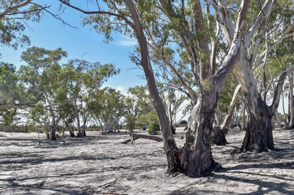
The following morning began with a drive up Murrayville Track, which is a well-formed track, minus a few surprise potholes that we had to keep our eyes peeled for. Our aim for the day was the Border Track, which Marc had read about years ago in a four wheel drive book as one of the “Top 100 Tracks of Australia.” Much to our disappointment, we arrived at the head of the track only to read a sign informing us that it was closed until end of March due to fire season. No Border Track for us. Luckily, some locals saw us turn around and advised us to take Cactus Bore track instead. Having had no back up option, we took their advice and headed off in the direction they pointed. Once the tyre pressure was correct, it was a relatively simple track but a good preview for bigger desert trips (i.e, Simpson Desert). Never underestimate the importance of having the tyre pressure right when it comes to sand driving. As we were driving along, just thinking we needed to find a good spot for lunch, the track opened up to an oasis of red gum trees (it’s marked on HEMA maps as “Red Gums”), and we thought “Perrrfect!”
After an enjoyable lunch, we continued on our way until we reached Murrayville track to cruise back to Broken Bucket. We were disappointed (but maybe also a little relieved…?) to see we had been joined by another couple in a camper van, but at least they had been considerate enough to set up on the opposite side of the campground. As a result we may have had a bit easier sleep that night.
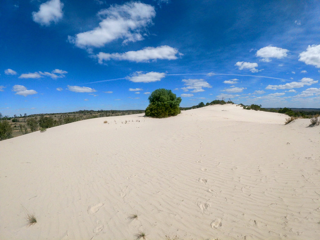
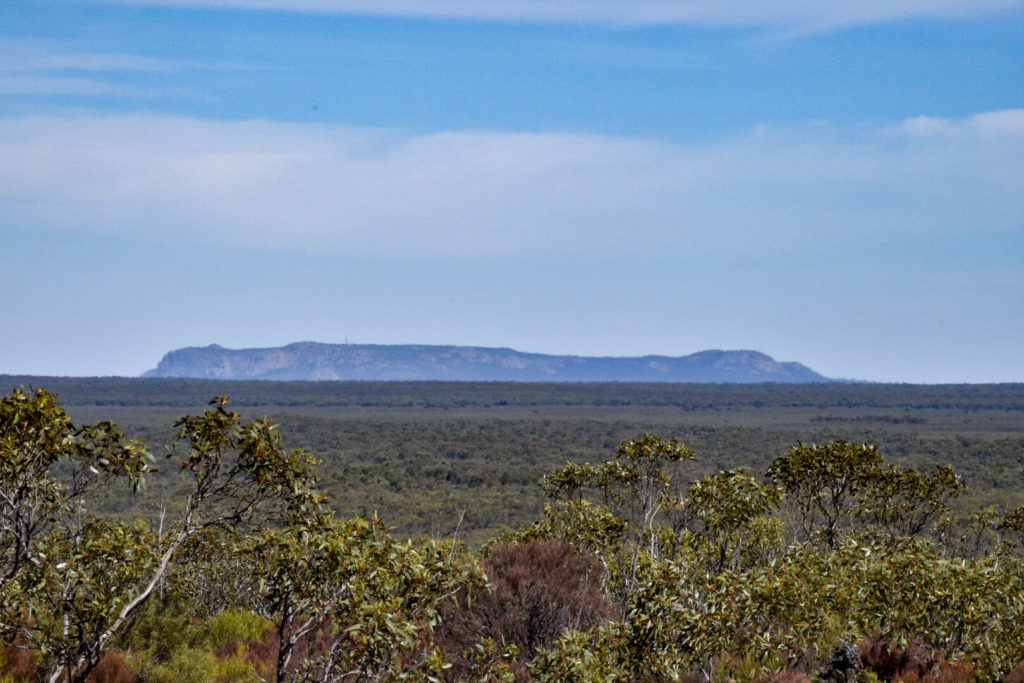
The next day we were off to Wyperfeld National Park, which is known for its four wheel driving. We started off along Netting Fence Track, which was still sandy but much simpler than the previous day’s track. We saw plenty of Roos skipping across the track as we drove through; otherwise, it was a pretty uneventful drive. Our main aim for the day was Snow Drift, a large white sand dune in the middle of the park. Looking at the map it seemed easy enough to reach, but we soon realised that was not the case. Many of the tracks mapped on HEMA and the information centre map were permanently closed, meaning we really had only one route available to us, which was a good 2-3 times longer than what we had planned, along some fairly corrugated sand tracks which meant pretty slow going. Just when we were about to give up and start high-tailing it back to camp, the white sand dune emerged. It was fairly impressive, something we would have been happy to travel to if it had only taken the time we had originally planned for. Since we were there we climbed to the top for views overlooking Wyperfeld and trialed sliding down the dune using a couple makeshift sleds sitting at the base but quickly realised why they were left behind as we seemed to sink in more rather than slide (surely it had nothing to do with the extra camp-side beers we had been having!)
From there we headed back along the highway and down Murrayville track back to camp. Being our third night there, we embraced the isolation a bit more comfortably than on night one.
The following morning we packed up and set back up at Kiata Campground in Little Desert National Park, a lovely and spacious campsite on the northern end of the park. Having had been forced to spend a lot more time in the car yesterday than we had anticipated, we were happy to stretch the legs and go for a bit of a walk instead. We chose the Trig Point Loop, an 11.5km walk through varying landscapes, up to sweeping views over the park and down south to Mount Arapiles.
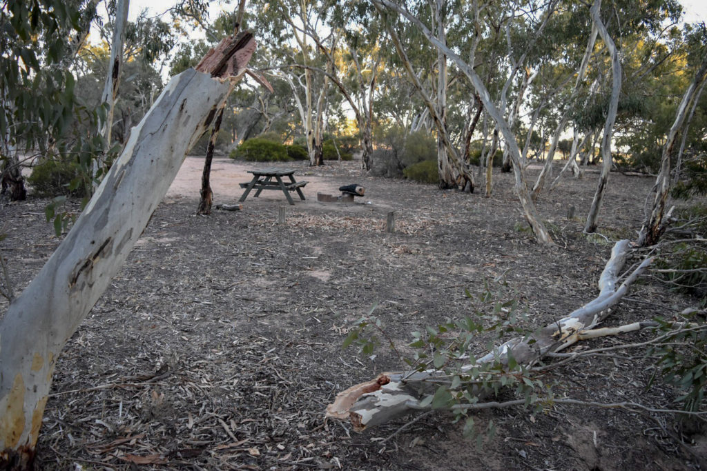
Afterwards, we had a relaxed night at camp, enjoying one of our last campfires before we would cross into South Australia soon, where there is a complete fire ban from November to April. That relaxation lasted until about 2 A.M., when I awoke to the sound of loud creaking, which continued to get louder until it was the unmistakable groan of a tree about to fall. I held my breath until the thud confirmed that the tree would not be hitting our van. We awoke the next day to inspect the damage and found ourselves quite lucky that the tree had decided to go the opposite way to our van. Always be careful when camping near gum trees; they can fall when you least expect it!
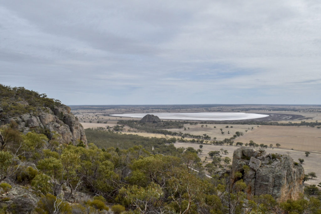
For our last day in Victoria, we drove down the middle of Little Desert along Salt Lake Track, which is nice and easy provided you have good clearance and the correct tyre pressure, on to Mount Arapiles. Mount Arapiles is known as “Victoria’s Uluru”, a monolith that emerges from the surrounding landscape in a very commanding fashion. Of course it is also only a fraction of the size of Uluru in the Northern Territory but impressive nonetheless. It’s quite popular with rock climbers and as soon as you get up close to the rock you can see why. Luckily for us, you can also easily drive to the top which we opted for over the climber’s route. From the top you get sweeping views over the surrounding countryside and down along the cliff face.
From there we drove back to Little Desert with a detour to the peaceful (and empty!) Horseshoe Bend for a quick dip to cool off. Tomorrow we would say goodbye to Victoria for the time being and cross into South Australia!