Arguably one of the Northern Territory’s most popular national parks, Litchfield is chock-full of iconic Top End scenery: gorges, waterfalls, bush walks, adventurous 4WD tracks, and a few hidden gems. Whether you want to day trip from Darwin or have several days to explore, Litchfield is a must-do for any visit to the Top End.
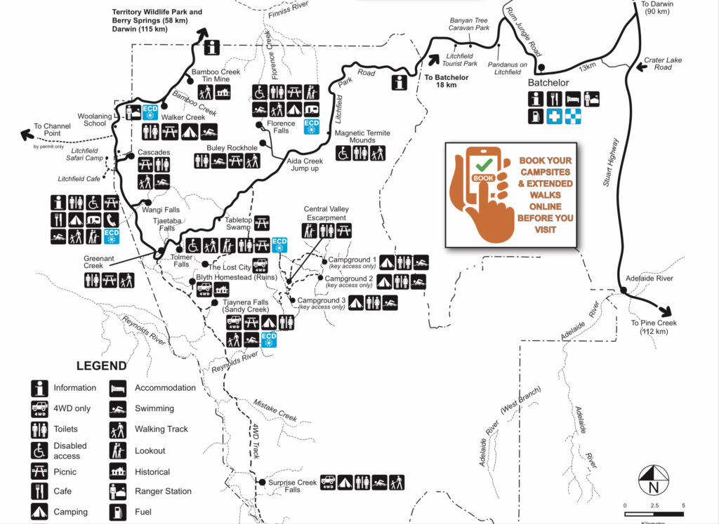
Much of Litchfield National Park is accessible by 2WD and is accessible year-round; however, some of the waterholes can be deemed unsafe for swimming during the wet or early in the dry season, so be sure to heed all warning and closure signs. Caravan-accessible camping is available year-round at Florence and Wangi Falls, while 4WD-only camping is available at Sandy Creek, Surprise Creek, and Central Valley during the dry season. There’s also fantastic walk-in camping during the dry season at Walker Creek. Note that although the Top End stays relatively warm in the winter, overnight temperatures can get pretty low in Litchfield, so be prepared; we had to resort to using our emergency heat blanket one night when we were camped at Florence Falls in July! For keen trekkers, there’s a 39km, 3-5 day hike known as the Tabletop Track that connects all the popular sights of Litchfield, which must be booked in advance. There are three access points to Litchfield: from the north via Berry Springs and the Cox Peninsula Road, from the east via Highway 1 and Batchelor, or from the south via Daly River Rd and the 4WD-only Reynolds Track. The north and east accesses from Darwin are fairly comparable for distance; the north access is probably a bit more scenic, and the east will be easier for those with bigger rigs.
FLORENCE FALLS AND BULEY ROCKHOLE
Coming from Batchelor, Florence Falls and Buley Rockhole are the first stops you’ll come to. They are located on the same access road, and what a lot of people don’t know is there’s a walking track connecting the two. The track, which is 1.7km long one way, is a well-signed and fairly easy walk except for a few inclines (and about 150 steps if you take the Florence Falls Lookout track — which you should!) that follows the Florence Creek, a year-round spring which feeds both the rockhole and the falls. Tip: if walking from Florence Falls campground, go to Buley Rockholes first, then take the lookout path on the way back. It’s much easier going down all those stairs than up!
If camping at Florence Falls, you can leave directly from the campground, or there’s parking available at both Florence Falls and Buley Rockhole. There are several stopping points along the track, with shady little pools to cool down on a hot day.
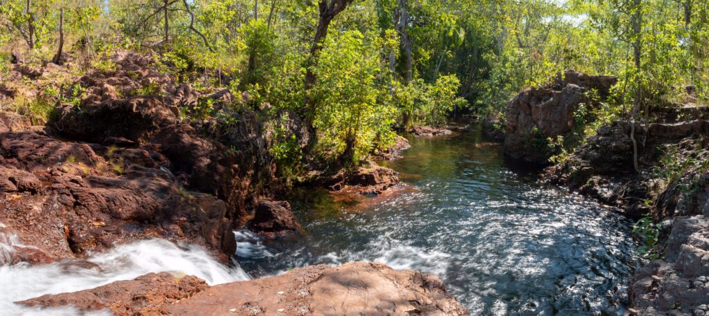
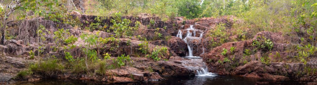
Buley Rockhole is a cascade of pools and small waterfalls, and even on a busy day it’s possible to find your own little nook, particularly downstream away from the carpark. Some of the plunge pools are deep enough for little cliff jumps, but be sure to always check the depth before jumping. And the rocks can be very slippery (we witnessed a couple hard falls whilst there), so take care when walking around.
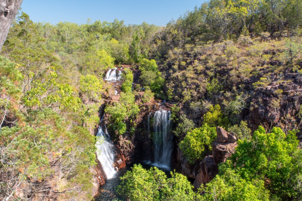
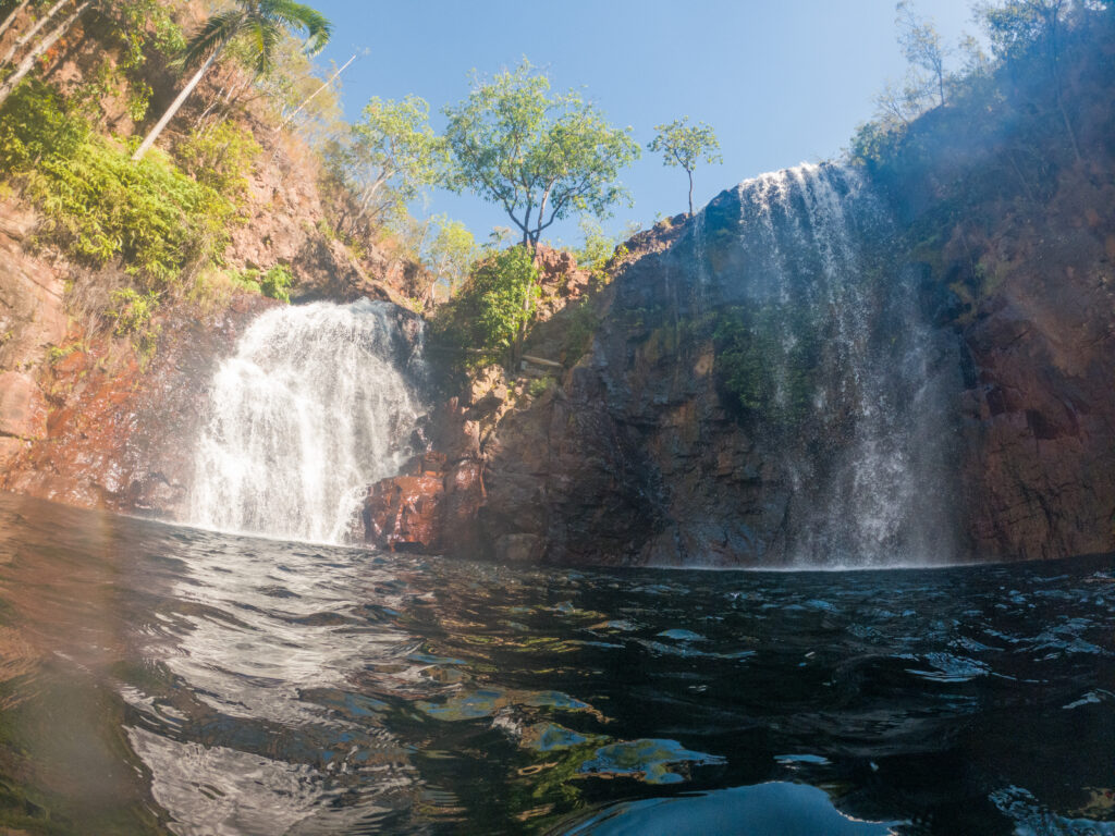
Florence Falls is comprised of two large waterfalls gushing into a lovely plunge pool. There’s two places to appreciate the falls: from the lookout (and the aforementioned 150+ stairs) or from the bottom, at the plunge pool. Access to the pool is easy via a platform and steps, and you can swim right up to the falls to experience the power firsthand.
For more information, check out the NT Parks pages on Florence Falls and Buley Rockhole.
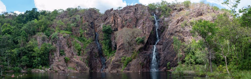
WANGI FALLS
The other most popular attraction of Litchfield, Wangi Falls, is located on the western side of the park, and like Florence Falls, it has 2WD access and a campground that is caravan-accessible. The Wangi Falls day use area is reminiscent of Leliyn/Edith Falls in that it has a nice grassy area with barbecues and a cafe, and pool noodles are highly recommended for the large swimming area! You can also take a 1.6km loop walk over the top of the falls and through a monsoonal rainforest. Although there’s not too many epic views, it’s a pretty walk through a couple different landscapes and you’re more likely to spot birds and other wildlife than at the busy day use area.
Find more information on Wangi Falls here.
TJAETABA FALLS (GREENANT CREEK)
Situated between Wangi and Florence Falls is Tjaetaba Falls, more commonly known as Greenant Creek. To get to the falls entails a 2.7km return walk, which is fairly easy except for a steep climb up to the falls at the end. There is no swimming allowed at the bottom of the falls for cultural reasons. At the top of the falls, there are a few pools to take a dip in, but caution must be taken as this waterway is not monitored. It’s a small area so although it’s a less popular spot in Litchfield, it can get busy quickly.
Find more information on Tjaetaba/Greenant Creek here.
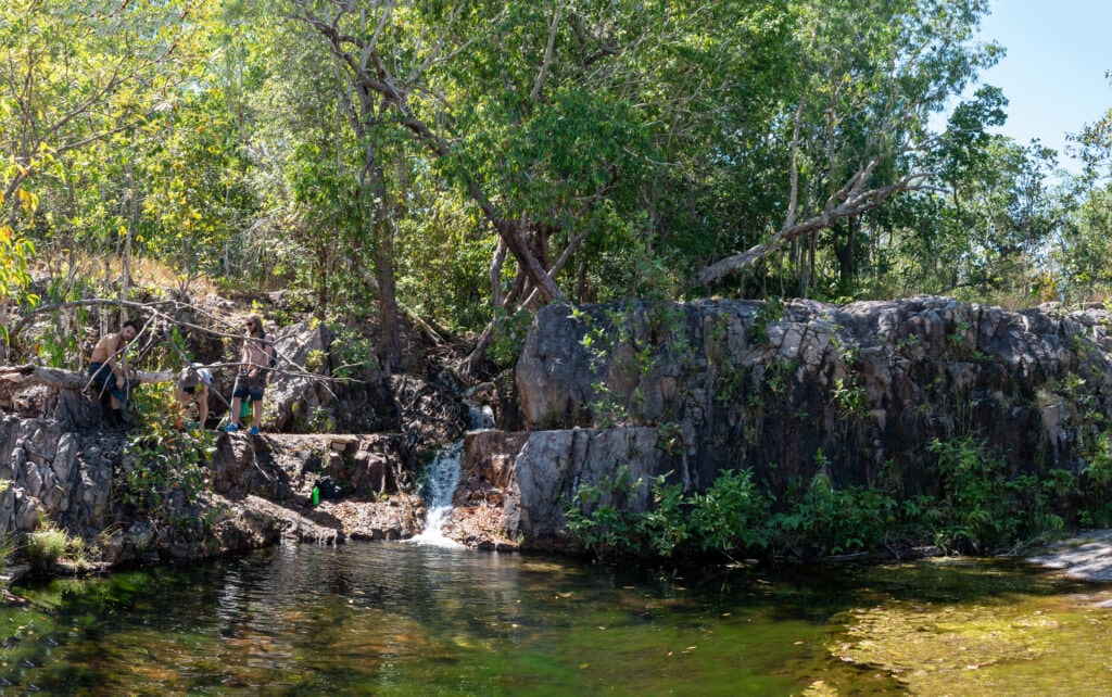
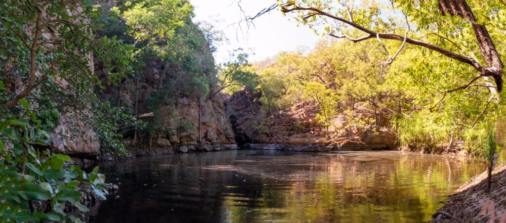
CASCADES
A bit further north from Wangi Falls is a blink-and-you’ll-miss-it turnoff to a track that leads to the Cascades, one of the less popular but still beautiful destinations in Litchfield. If you’re comfortable with a bit of scrambling over rocks and sides of waterfalls (nothing too dangerous or strenuous), you can take the Lower Cascades track which is shorter and shadier.
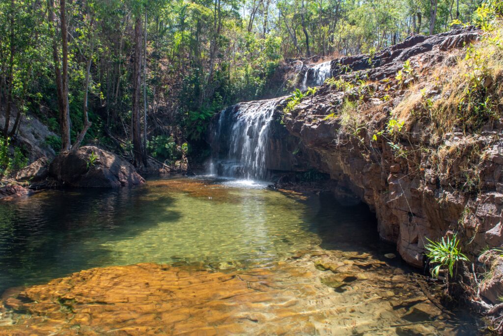
If you’d rather take a proper walking track, the Upper Cascades track will be longer and more strenuous, but it doesn’t require any rock scrambling either. There are a couple beautiful little waterfalls in the lower Cascades, and plenty of delightful, shallow rock pools in the upper Cascades. It’s a fairly large area so there’s plenty of room for visitors to spread out.
Find more information on The Cascades here.
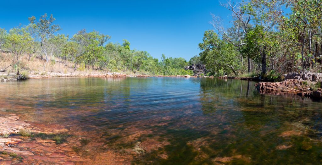
WALKER CREEK
At the north-west entrance to Litchfield is Walker Creek, a creekside day-visit area and campground. There are 8 campsites, each one fairly private and with its own fire pit. During the busy season and especially on weekends, you’ll need to get there early (crack of dawn early) to secure a campsite as it’s first come, first served; to “reserve” a campsite, you must write your details on a board at the trailhead. The furthest campsite is only a couple kilometres from the carpark, but you’ll still probably want to backpack all your gear in. If you’ve missed out on a campsite (like we unfortunately did during our visit), there are still day use areas and pools available to enjoy the creek.
Find more information on Walker Creek here.
TJAYNERA FALLS (SANDY CREEK) AND SURPRISE CREEK
Our visit to Tjaynera (Sandy Creek) and Surprise Creek was probably our favourite of all the sights in Litchfield. A high clearance 4WD is a necessity for the Reynolds Track, especially early in the dry season as there are a couple river crossings, and these spots are definitely not accessible during the wet. There are two points to access the track: the north end meets up with Litchfield Park Road near Greenant Creek, and the south end connects to the Daly River Road. Basic camping is available at both Tjaynera and Surprise Creek on a “first in, best dressed” basis; we chose Surprise Creek as it’s a bit further away from the rest of the park so it tends to be a little less busy than Tjaynera.
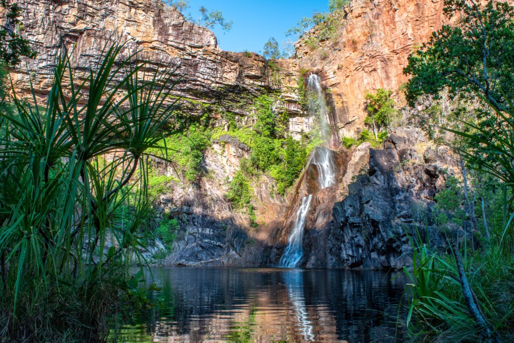
Tjaynera Falls is an easy 1.4-kilometre walk from the day use area or campground to a lovely tall waterfall and picturesque waterhole. It’s especially stunning later in the day as the rocks start to glow from the setting sun.
The waterfalls at Surprise Creek are also easily accessible from its campground. The first large pool you see at the end of the track is nice, but the real surprise comes when you turn the corner to find two spectacular rock pools, one feeding into the other.
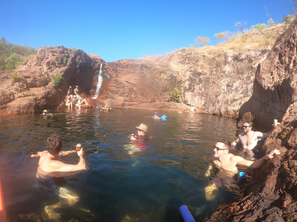
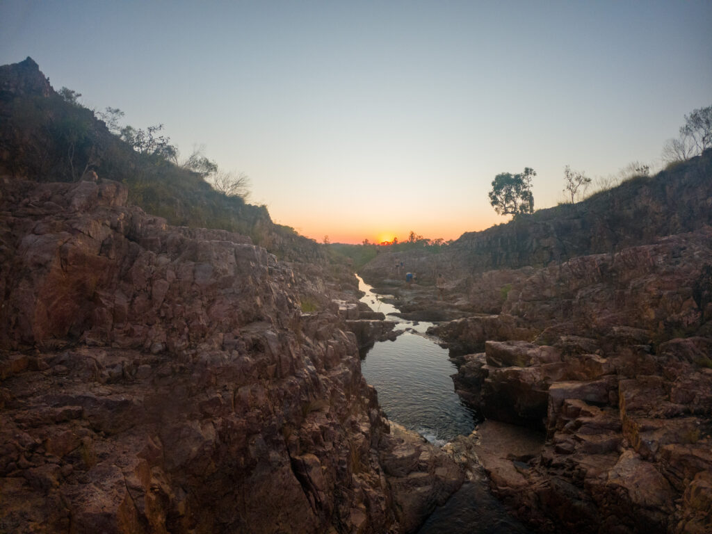
The pools are big enough to have a float, try a couple jumps off the ledge, and plenty of rock space to sun bake. The top of the falls makes a great place to watch a legendary Top End sunset, just don’t forget a torch for the way back.
Find up-to-date information on the condition of the Reynolds track here.
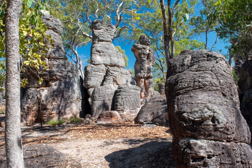
CENTRAL VALLEY AND THE LOST CITY
The Lost City is located on a track off Litchfield Park Road, about 5 kilometres west of the Florence Falls turnoff. It is 4WD access only due to soft sand and is only accessible in the dry season. Once you’ve tackled the track, it’s an easy 600m walk amongst these interesting sandstone towers that are estimated to be over 500 million years old. More information can be found here.
On the same turnoff as the Lost City you’ll find Litchfield’s newest campground, introduced in late 2021, known as the Central Valley campgrounds. There are 3 separate areas and campsites are limited to 32 sites; they are accessed with a Parks-provided key and need to be book far in advance due to their popularity. And it’s perfectly understandable why these campgrounds are so popular; each drive-in campsite has its own private camping area, firepit, and adjacent swimming hole…what more do you need? Find more information, including links to road conditions and booking, here.
SYBEL SPRINGS
A bonus, off-the-beaten-track spot just out of Litchfield is Sybel Springs. 4WD only access is located on an unmarked track on the left when heading east along Daly River Road from the Reynolds Track, just when you get out of the official national park. The track meanders through the forest, crossing over some decent washouts then gradually climbs up a hill before finishing in a small carpark at the top, and from there you walk down a steep track to the creek. At its best early to mid dry season, there are waterways to explore further up from the carpark. Be croc-wise here; these waterways are not regularly, or probably at all, monitored.
SUGGESTED ITINERARIES
Here are suggested itineraries for Litchfield National Park, coming from Darwin, depending on how much time you have to make the most of your visit:
Day visit – Make it a loop starting with Florence Falls and Buley Rockhole in the morning, and Wangi Falls in the afternoon. Florence Falls swimming area is a bit smaller, so you want to do that earlier in the day. Also, Wangi gets better sunlight later in the day, and it’s a massive swimming area so there’ll always be plenty of room
Overnight stay – Do the above, staying at Florence or Wangi campgrounds for the night, then explore Tjaetaba Falls (Greenant Creek) and Cascades as well
2 nights – One night at Florence or Wangi campground, the second night at Tjaynera/Surprise (4WD-only) or Walker Creek (walk-in)
3+ nights – From the above, add in a stay at the Central Valley campgrounds — we didn’t make it here but it’s meant to be pretty epic!