Now from Mount Remarkable NP, we had two options to get to Alice Springs: straight up the Stuart Highway (AKA the boring bitumen way) or along the Oodnadatta Track. I’m sure you can easily guess which one we chose.
Our journey began in the small country town of Lyndhurst. Their welcome sign is not only identical on both its sides, the town population is cheekily stated as “30 (most days)”.

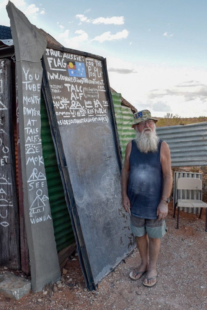
One of the more eccentric members of this population, Talc Alf, is well worth paying a visit. For several decades now (Marc remembers seeing him when he travelled around Australia at age 4), Talc Alf has been using talc from a nearby talc mine to carve his artwork.

He loves a good chat and has interesting views on numerous topics, including the origins of the modern day alphabet.
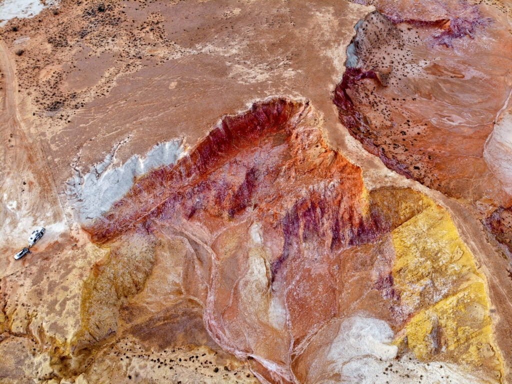
A few kays north of Lyndhurst is the Ochre Cliffs. Ochre is of great importance to the Aboriginal people, used in many aspects of their culture from art to bodily decoration for rituals . It’s hard to believe that these vibrant colours occur naturally and in such large quantities as is found here.
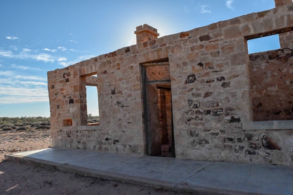
Further up the road is Farina, a true Outback ghost town.
That night we spent in Marree, at a great little free camp next to the Marree Hotel.

Up until this point, besides a cracked water pipe coming out of the Gammon Ranges, our van had been fairly “injury” free. From the moment we left bitumen at Lyndhurst until we got to Marree, we had been really lucky in that while we were on gravel roads, they were almost as smooth as bitumen (little did we know that road was to be paved in the near future).

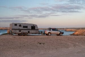
However, that all changed as soon as we moved on from Maree. The road became rough, rocky, and corrugated. While we noticed this and could definitely feel it in the car, we still thought we were driving appropriately. That is, until we got to our next camp for the night at Coward Springs. Getting into the van to start setting it up for our stop, the first thing that we saw was the microwave; it had shifted a full 90 degree turn from where it was meant to be. The oven was sitting noticeably crooked. One of our exhaust fans had fallen out of its brackets. Our tyres had a few small chunks missing. The moral of the story? Drop tyre pressure and drive to the conditions! We spent the rest of the track putting along at a much slower speed, getting passed by all the unencumbered four wheel drives and caravan-towing drivers yet to learn their lesson just as we had.
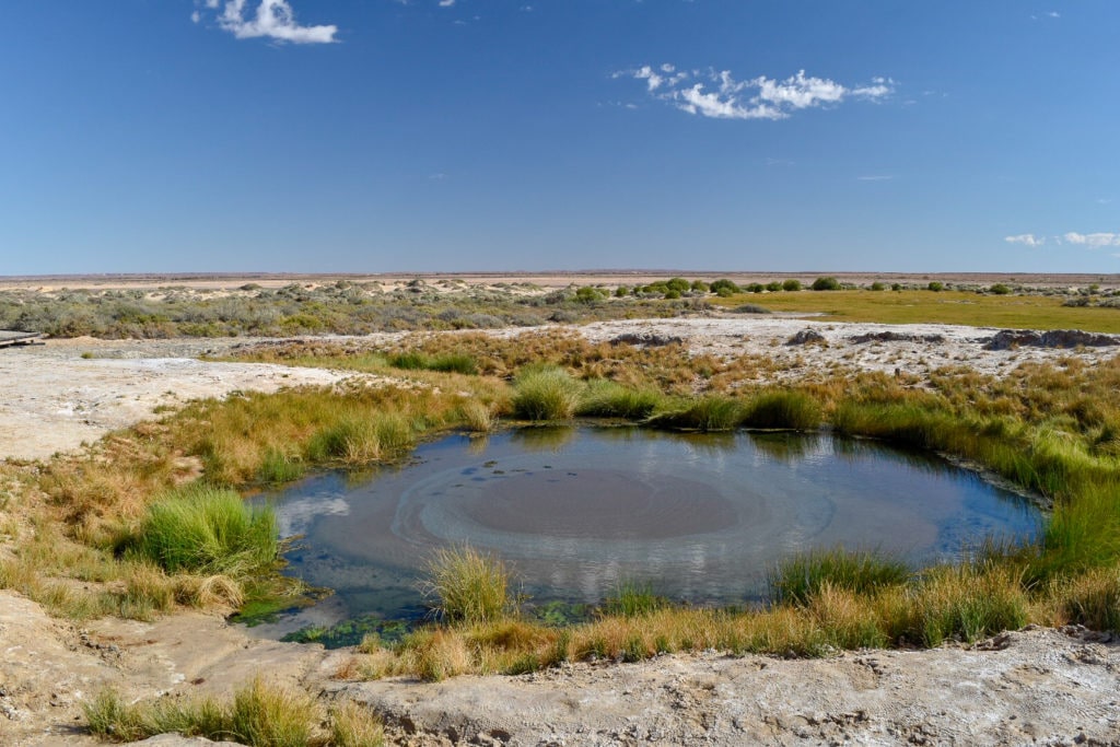
To help ease the stress of finding several things damaged in the van in one go, we were able to relax at the campground’s beautiful artesian springs, a lovely little oasis in an otherwise very barren landscape.

There are further signs of water just down the road at Mound Spring and The Bubbler. All these springs are fed from the Great Artesian Basin, which lies under approximately 1/5 of Australia. The water that is visible can be up to 2 million years old!
One of the main reasons we chose to take the Oodnadatta Track, besides it being a more interesting route north than a major highway, was to see Kati Thanda-Lake Eyre. At about 15 meters below sea level, it is the lowest point in Australia and is also Australia’s largest lake. It rarely has water in it and even less often does it fill to capacity, so when it does, it really comes alive. The last time there was water in Lake Eyre was 2010 and the last time it filled to capacity was in the 1970s! Due to flooding in Queensland and Northern Territory earlier in the year, the lake was filling up in a way not seen for 45 years. We first saw the lake at the southern end, where the water hadn’t quite reached yet, so to get a true appreciation, we got up early the next day to take a scenic flight from William Creek.

The water was absolutely still, creating a perfect mirror image of the sky above, and boy, was it stunning! The pilot said that they have to be careful when flying close to the surface as it can become quite disorientating and difficult to tell the difference between sky and earth.

From William Creek, we continued on to the town of Oodnadatta, deemed the hottest, driest town in Australia. It’s known for the famous Pink Roadhouse and makes a great base to explore the multi-coloured hills of the Painted Desert.

After that detour, we drove through the remainder of the Oodnadatta until we met the Stuart Highway at the town of Marla. Never were we so happy to see bitumen again! Our next stop: Alice Springs!