Leaving the Gammon Ranges for the Flinders Ranges, we were sceptical…how could it get better than what we just came from? To top it off, we were about to have our first run in with school holidays when we were used to seeing maximum one or two cars a day. However, we quickly realised that for what the Flinders lacks in remoteness, it easily makes up in awe-inspiring beauty.
Ikara-Flinders Ranges (Ikara meaning “meeting place”), being much closer to Adelaide than the Vulkathunha-Gammon Ranges, tends to be much more visited than its northern counterpart. Which, as we were driving through on day one of school holidays and noticing significantly more traffic around, we tried not to hold it against the Flinders. To be fair, it was nothing compared to trying to drive out of Melbourne on Good Friday, but still…
The traditional owners of the land are the Adnyamathanha people, which translates to “people of rock/hill” which makes perfect sense when you see the place. The park is probably most well-known for Wilpena Pound, an impressive, crater-like formation at the southern end of the park. The pound, which gets its name from early settlers using it as a pound or animal enclosure, is actually formed by intense pressure forcing earth upwards to create the circular cliffs, and it is spectacular. But we’ll get to that one later.
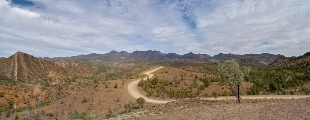
Our first stop after unhitching the van at Trezona campground, a lovely wooded camp near a dry creek bed, was the scenic drive through Bunyeroo Gorge. Bunyeroo Road winds between the two main ranges of the park, the Heysen and ABC Ranges.

The Heysen Ranges is named after Sir Hans Heysen, a German-born Australian artist. The ABC Ranges are thus named due to there being as many (or more!) peaks as there are letters in the alphabet. We’ve never seen so many lookouts packed into such a short distance; just when you think you’ve seen the best of it, the next stop tops it. It didn’t take long for the Flinders to win us over.
From there we continued on to a couple locations of ancient Aboriginal art and carvings, Arkaroo Rock and Sacred Canyon, which included being eyed off by a not so friendly-looking feral goat!

We quickly discovered there was no shortage of beautiful drives in the Flinders. The Brachina Gorge Geological Trail is like a drive through history, up to 650 million years history to be more exact; along the drive you can stop and see a variety of different, very ancient fossils up close. Not to mention Brachina Gorge itself is stunning, and you may see the occasional yellow-footed rock wallaby as they have a protected habitat there. From Blinman (the highest surveyed town in South Australia at 610 meters), we also did a drive through Glass Gorge, not a challenging drive as it can be completed in a 2WD but great scenery nonetheless

For more challenging 4×4 drives, Skytrek in Willow Springs Station is the place to go. It’s one of many “pay to play” 4WD tracks in the area, meaning you pay a fee to do a “self-guided tour.”
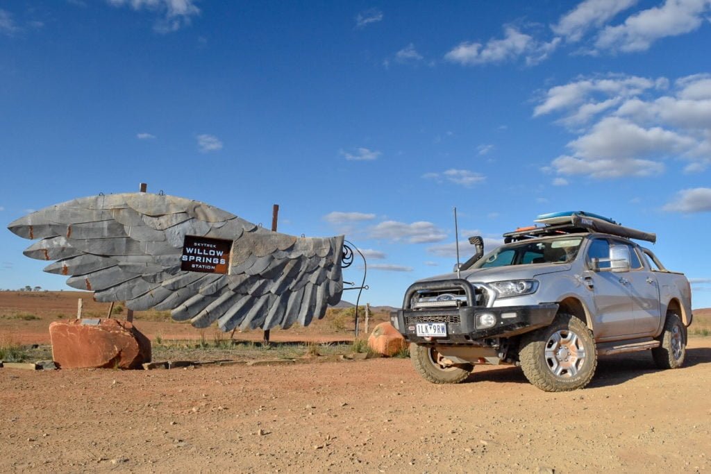
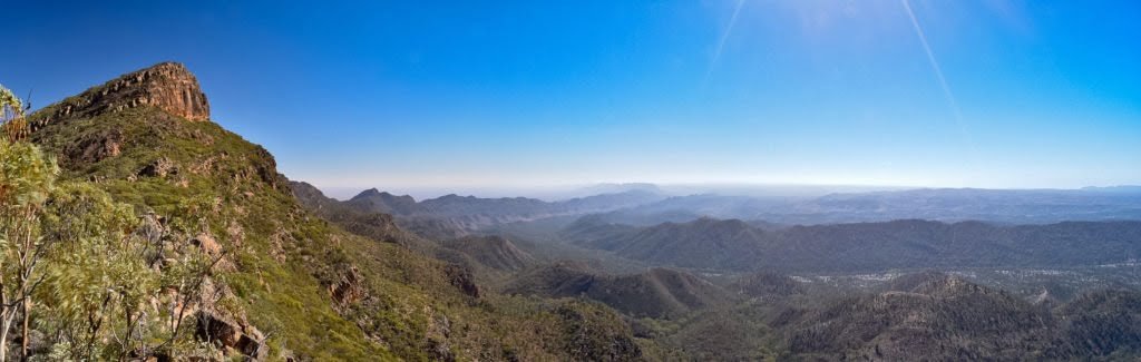
To do their main track, Skytrek, you need to start no later than 10 am, as it’ll take most of the day to complete. It was full of fun challenging tracks and was my (Sandy’s) most difficult 4×4 drive yet. But I got through it, and more importantly so did the car! Besides just being a super fun track, there are some pretty amazing views over the station, Flinders and Wilpena Pound as you’re driving around, so we couldn’t help but stop multiple times along the way to take it all in.

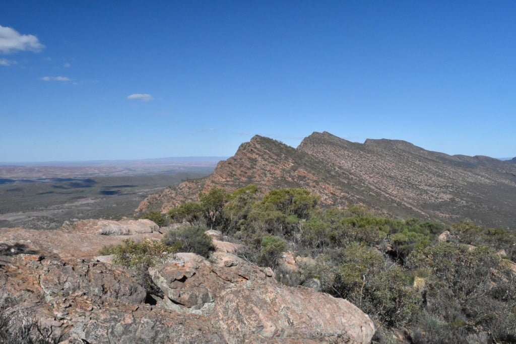
On days we were feeling more energetic, we opted to do some of the many walks in the park. On ANZAC day, we got up before sunrise, trekking the 4 kms to Red Hill Lookout just as the sun was peeking over the ranges. We had perfect 360 degree views of ABC Ranges and the valley below. It felt like a great spot to have our own “dawn service”.

Later on that day, we still had enough in us to complete the 6.4km return hike up Mount Ohlssen Bagge. This walk is known for great reptile life (of which we saw a bit) and spectacular views of Wilpena Pound, but be prepared to sweat for it! It’s no surprise that they shut the walk in the summer months. In hindsight, it would have been wise to do this one at the start of the day before the sun really starts to bear down on you.

And for the best views yet, St Mary Peak Hike is the best option. It starts out fairly level, then for the last hour you climb up the outer cliff of the pound which can get quite scrabbly in places. The Adnyamathanha ask that you not climb to the summit of the peak as it is an extremely sacred place in their Dreamtime stories, but the views you get from the cliffside are more than satisfactory. You get a true appreciation of why the Flinders Ranges are called the Spine of the Outback.
From there you have a choice: climb back down the way you came or take the 12-13km loop around to the trailhead. We took the loop option but honestly after the first few kays it got fairly monotonous. There is a nice looking campground which if we had our gear would have been great to break up the hike a bit.
Although the Flinders Ranges had a hard act to follow, it very easily won us over with its range of activities both on foot and behind the wheel. From Flinders, we started heading east. “But you just came from there!!” you might be currently yelling at the screen. Yes, this is true…we had a special event to be back for in Melbourne, and we got to tick off some bucket list places back in Victoria, as well as discover some real hidden gems.