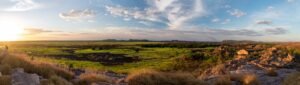
Most people who’ve been to the Red Centre have visited or at least know about the West MacDonnell Ranges (known to locals as the “West Macs”). They’re fairly easily accessible and have some of the most stunning gorges and waterholes you’ll ever see. If you ask these same people about the East MacDonnell Ranges, you’re likely to be met with a puzzled look and a response of, “There’s an East MacDonnell?” Heck, it’s not even clearly designated on most maps of the region! Now don’t get us wrong; the West Macs truly are fantastic, but they lack a certain sense of adventure, of “off-the-beaten-track”-ness. That’s where the East Macs really shine.
Yeperenye (Emily and Jessie Gaps) and Corroboree Rock

The journey through the East Macs begins from Alice Springs via the Ross Highway, which starts off as a dual lane highway, offering easy access to sites such as Emily and Jessie Gaps and Corroboree Rock. These sites are culturally significant to the Arrernte people and are well worth a stop. Eventually the road narrows into a single lane; it’s still a good road but requires caution regarding oncoming traffic going around some of the bends.

Trephina Gorge

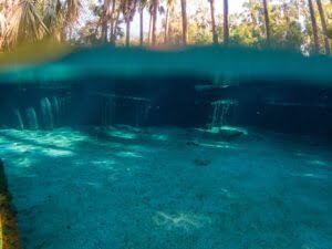
About 70km out of Alice you’ll reach the first turnoff, which is for Trephina Gorge. On the way to the gorge, there is a 300 year old Ghost Gum which is thought to be the largest in Australia. If you have a 4WD and aren’t towing a caravan, you have the option of taking John Hayes Rockhole Track to a secluded camp and delightful, slightly challenging walk known as the Chain of Ponds. Having been a significantly dry year, the water levels of the rockhole were low, but after a good rain they can be positively overflowing with water and be a great spot for a swim (although very cold!).

Trephina Gorge offers caravan-accessible camping and numerous walks, from a 500 meter stroll through the creek bed to admire the gorges from below or a 2km circuit walk to admire them from above. The gorge is especially spectacular as the sun sets and the gorge walls come alight in a fiery red. Dingo sightings are common, so keep an eye out and be sure to not leave any food or rubbish out.

N’Dhala Gorge

Rejoining the Ross Highway heading East, it’s not long before you meet a fork in the road. Following the bitumen to the right will take you to two places: Ross River Resort, and the track to N’Dhala Gorge. N’Dhala Gorge is considered to be an “outdoor art gallery” of sorts with hundreds of petroglyphs that date thousand of years old dotted around the short 1.5km return trail. There is also a basic campground with drop toilets and fire pits located at the gorge.

Arltunga Historical Reserve

If you turn left at the fork in the road, you leave the bitumen as you follow the unsealed Arltunga Tourist Drive to the Arltunga Historical Reserve. Arltunga was founded in the late 1880s by gold miners and is considered one of the first major settlements in Central Australia. However, due to the scarcity of gold and harsh living conditions of the region, the gold rush was brief and by the early 1900s, the settlement was abandoned. The visitor centre has a wealth of information about the history of the settlement and its people, and at most stops there are information sheets to help guide your walk. Highlights include the Government Works and the Great Western Mine, the largest of the gold mines in the region. From here you continue on towards Ruby Gap, saving the best for last

Ruby Gap Nature Park

Ruby Gap Nature Park is truly the jewel of the East Macs (pun fully intended!). The park gets its name from a case of mistaken identity: in the late 1880s, surveyor and explorer David Lindsay thought he found rubies in the creek bed of the Hale River, triggering a mining rush to the area. Unfortunately, the “rubies” were actually garnets and practically worthless, but the area kept its name nonetheless. Although fossicking is not permitted, you can still see remnants of these infamous garnets where the sand turns from white to a sort of dark, purple-ish colour.

Ruby Gap is approximately 150km from Alice Springs, which doesn’t sound like a lot, but almost 50km of that drive is along a winding dirt track that varies from white bulldust to red dirt, from rocky steps to sandy creek beds. We ended up with a punctured tyre on our drive in; thank goodness for tyre repair kits! Now don’t let this deter you; it’s still well worth the trip. It’s only important to mention so that visitors to the park are prepared. Remote Central Australian terrain is not merciful, and being less visited means you’ll be less likely to have someone pass by to help you out if you get stuck. Make sure you drive to the terrain and bring the necessary equipment to be as self-sufficient as possible.

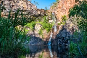
The biggest mistake people make when visiting Ruby Gap is getting to the first signs of water, getting out of the car, having a short look around, then getting back into the car and driving off the way they came. This stopping point not only makes for a ripper of a campsite, but from here you can choose to either walk or drive another 2km (keeping in mind what’s been previously mentioned regarding the track) to Glen Annie Gorge. Here you’ll be treated to a stunning waterhole, the only permanent one in the East Macs, framed by impossibly red gorge walls. Even in a drought, this spot is teeming with water and life and offers a refreshing spot to cool off on a hot day.

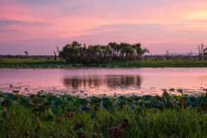
It’ll be hard to tear yourself away from this magic spot, but you can be almost guaranteed to return to your campsite for another dramatic sunset against the gorge, along with a possible serenade from a chorus of frogs, with the occasional guest vocals of a lone dingo, as you take in a spectacular night sky.
What do you reckon? West (Macs) is Best, or do the East Macs trump them? Let us know below!