Hobart and the surrounding region south is a great base to get a feel for why so many people rave about Tasmania, whether you stay a weekend, a week, or more. It’s got interesting history, great produce, and some of the most pristine and untouched scenery in Australia.
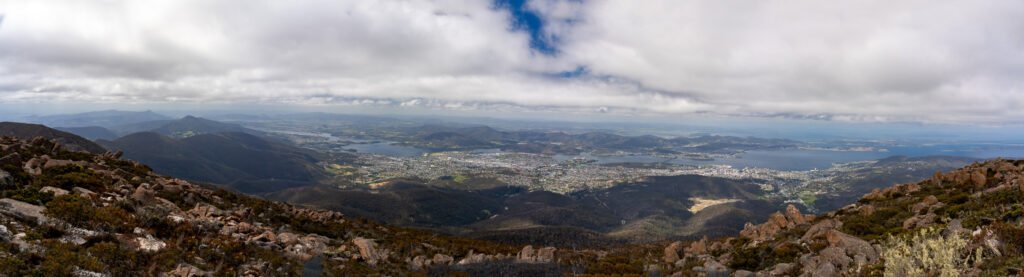
The best place to start a visit to Hobart is with a trip up kunanyi/Mt Wellington, which towers 1271m over the city. Most people drive to the summit, which takes about 30 minutes, but if you are keen you can hike to the top as well, which is challenging and will take you about 2-3 hours return. It is also a popular mountain biking destination, with plenty of tracks to choose from. Prepare for any kind of weather up here; even in the summer it can snow! You can check on current conditions, including a live webcam here.
Most people will agree, no visit to Hobart is complete without a visit to the Salamanca Markets. Surrounded by historic sandstone buildings with kunanyi/Mt Wellington in the background, this eclectic market held every Saturday has much to offer, from local honey to art work to wallaby burritos (don’t knock them ‘til you try them!)

It makes the perfect spot to pick up a local souvenir, a gift for a loved one, or tasty treat for yourself. Another lesser known market but still quite good in its offerings is the Farm Gate Market, located on trendy Bathurst Street, which mainly focuses on fresh produce.
Enjoy a cold brew? There’s no better place to visit than Cascade Brewery, Australia’s old brewery. Enjoy a beer out in the garden overlooking the historic buildings, or go for a stroll on one of the lovely bushwalks in the area.

This region is also known for some spectacular wines and whiskeys, especially in the Coal River Valley region east of Hobart. Some of our favourites include Sullivan’s Cove, Frogmore Creek, and Puddleduck.

Mount Field National Park
Mount Field National Park, a 1.5 hour drive from Hobart, is one of Tasmania’s most accessible, and therefore popular, national parks. The drive from Hobart through the Derwent Valley is in itself an attraction, as it winds through pristine forests and alongside rivers and creeks, with plenty of options to stop to pick up some of Tasmania’s famed fresh produce. One of the more known stops is Willie Smith’s Apple Shed, with its well-loved apple cider and enticing eatery.
Mount Field has plenty of hiking options for various abilities and fitness levels. The most popular stop is the lovely, tiered Russell Falls.

You can also incorporate this stop into the 3 Waterfalls loop hike, which also takes you to Horseshoe Falls and Lady Barron Falls. Another recommended walk is the short Tall Trees hike, where you can admire Australia’s tallest tree, the swamp gum AKA mountain ash.


A caravan-accessible campground is located a short distance from the info centre and offers many amenities, including power and water hookups (note: Tasmania is the only state that we’ve come across that offers powered sites in some of its national parks!)
Hartz Peak and Tahune Airwalk
Around this area west of Hobart, there are countless options for peaks to summit, most of which have been carved out by glaciers over centuries. One of our favourites was Hartz Peak in Hartz Mountains National Park. The 1.5 hour commute from Hobart includes a drive through the scenic Huon Valley, another region known for its excellent produce.

The walk is rated a Grade 4, climbs 400m in elevation and is 7.4km long. At the top of the 1254m high peak, on a clear day you will have magnificent 360 degree views of the national park and surrounding area.

The Tahune AirWalk features a walkway suspended approximately 50 metres above the ground over a temperate rainforest. Unfortunately a recent fire had destroyed much of the forest below; therefore, our visit was not as spectacular as it probably once was. The good news is that the Australian bush is very resilient when it comes to fire, and this area will recover and hopefully return to its previous glory one day. Other optional activities include river rafting tours and hang glider rides.

The Southernmost Point of Australia
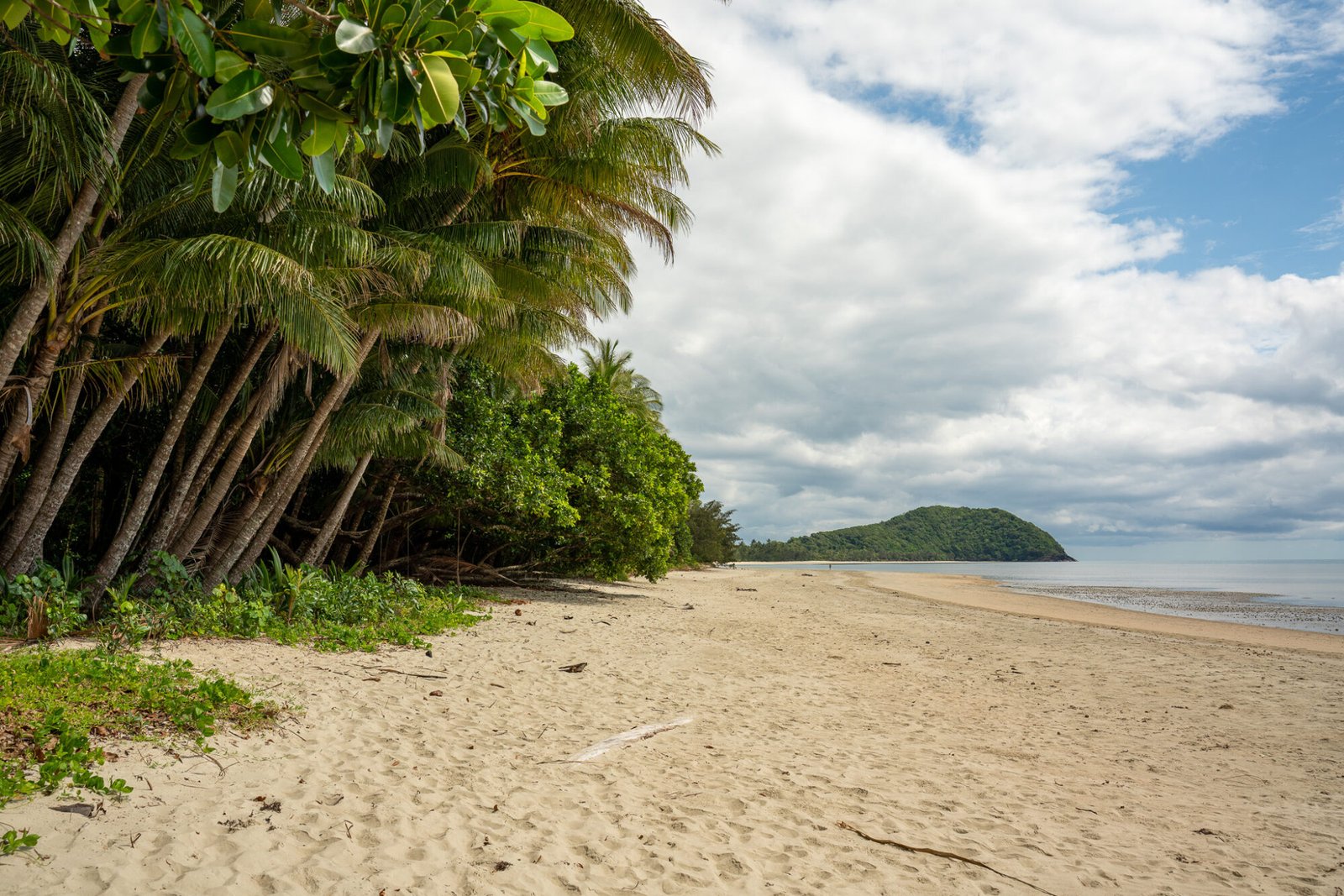
If, like us, you enjoy ticking off special compass points around Australia, then a trip to Cockle Creek, about 2 hours drive south of Hobart, is a must. From here you can hike 8km to South East Cape, the southernmost point of the Australian continent…well, actually you can SEE the southernmost point. Unfortunately, the southernmost point isn’t accessible even on foot, so it’s a little bit anticlimactic unlike other compass points such as Steep Point and Cape York. Nevertheless it’s a fairly easy walk and Cockle Creek has a very pretty beachside free camp. If you’re a keen hiker, you can continue this trail along the South Coast Track, a 6-8 day hike through some of the most remote territory in Australia.

Mystery Creek Cave
Another worthwhile nearby attraction, and a bit of a local secret, is the Mystery Creek Cave. At the entrance to these caves, you’ll find a sign that describes the increasing level of difficulty as you enter further in the cave. Be sure to heed the warnings and to not go past a point that is beyond your ability.

And make sure you have a head torch or light! In the cave, there is no infrastructure whatsoever and you are free to explore wherever you wish. Once you are in far enough that there is no more natural light, turn off your torch and allow your eyes to adjust to the darkness. If you look up, it will seem as if the night sky and stars are slowly coming into focus, but what you are actually seeing is thousands of glow worms illuminating the roof of the cave. It is quite a sight to behold. On the track to and from the cave, keep an eye out for the elusive lyrebird; you’ll more often than not hear their call rather than see them.
Bruny Island
One of the most popular day trips from Hobart is to Bruny Island; although, we would recommend at least an overnight stay as there is a fair bit to see and do on this small island. The ferry point from the Tasmania mainland is located in Kettering, approximately 45 minutes’ drive from Hobart. Run by Sealink, the ferry departs every 20 minute (so it’s not necessary to book ahead) and takes about 15-20 minutes.
The drop off point is on North Bruny Island at Roberts Point, conveniently close to the Bruny Island House of Whiskey, with a fantastic selection of tipples. While North Bruny Island is worth an explore, most of the attractions of the island are on South Bruny Island, so we recommend allotting most of your time there, especially if you are only visiting on a day trip.
Heading south from the ferry terminal, one of the first scenic stops you’ll come to is The Neck, a geological formation where the land tapers into a narrow strip of land that connect North Bruny to South Bruny. Here you’ll find Truganini lookout (be sure to read the signage telling the story of the namesake of this lookout), a beautiful long stretch of beach, and a Little Penguin colony.

When you start to feel a bit peckish, Bruny Island Beer and Cheese Co. is a perfect place to satisfy these cravings. They have an extensive selection of cheeses and beers, which can be enjoyed onsite or as takeaway to tuck into at a later time. We wish we could recommend a favourite beer and cheese, but honestly they were all so good, so you’ll have to try it for yourself!
If carbs are a passion, be sure not to miss out on the Bruny Baker. This bakery is unique in that you won’t find its baked goods inside of a brick and mortar building; instead, they can be found in a fridge on the side of the main road through Bruny Island (search “Bruny Baker Bread Fridge” on Maps), which is filled by the baker every morning and runs off of an honesty payment system.

While this sounds a bit unconventional, we can confirm that the sourdough bread was exceptional, and the other treats looked delectable. Get there early to avoid missing out as this bakery has become quite popular in recent years; however, apparently you can also order ahead.

For those who like to explore on foot, there are a number of hiking trails with varying scenery for each. The Cape Queen Elizabeth Track is located just north of the Neck and takes about 3 hours return. It is rated moderate due to undulations and sand walking which leads to beautiful rock formations including Mars Bluff Arch.

Even though it’s a bit of a steep hike to finish, walking to the end for the views is well worth it!

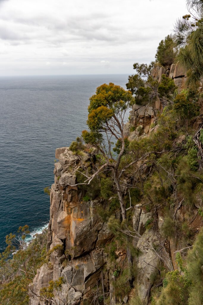
Nearby Fluted Cape Track is a 2.5 hour return walk and is quite steep but leads to great views over the cliffs. It is not recommended for those with small children.
The convict built Bruny Lighthouse at the southern point of the island has more sweeping views over the sea cliffs and beachside settlements; tours are available.

There are numerous accommodation and camping options on the island. The two camps that were most recommended were Cloudy Bay and Jetty Beach, both of which are caravan accessible. Cloudy Bay was our preferred option during our visit as it is less easily accessible due to having to drive along the beach for part of the track and therefore tends to be less busy. However, the tides were not in our favour so we went to Jetty Beach instead, which consisted of a wooded campground and tracks that led down to a beautiful little white sand beach — not a bad consolation prize! We did the hike of the Labillardiere Peninsula, which was nice to stretch the legs.

This is by far not an exclusive list of what there is to see and do in and around Hobart. This region is so full of attractions that it would be impossible to fit in to one post! One such place that deserves its own mention is the remarkable Tasman Peninsula.