As seen in Pat Callinan’s 4×4 Adventures, Issue 42
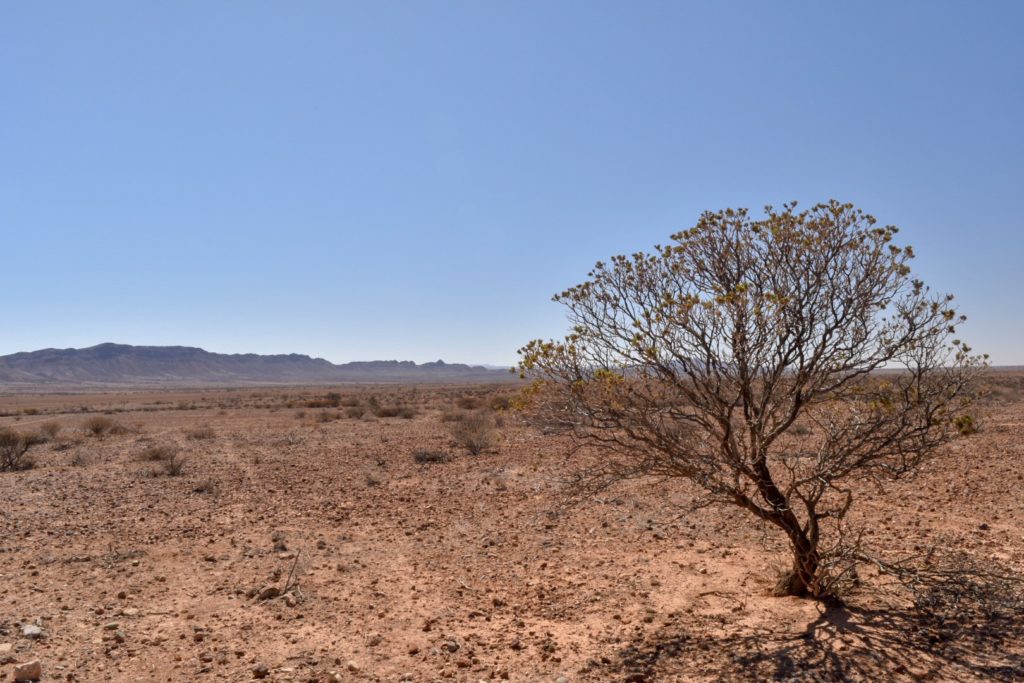
As the infrastructure of Adelaide melted away and we drove north towards the Gammon Ranges on the Outback Highway, also known as the Explorer’s Way – what a name for a highway! – the first thing that struck us was how dry the area was.
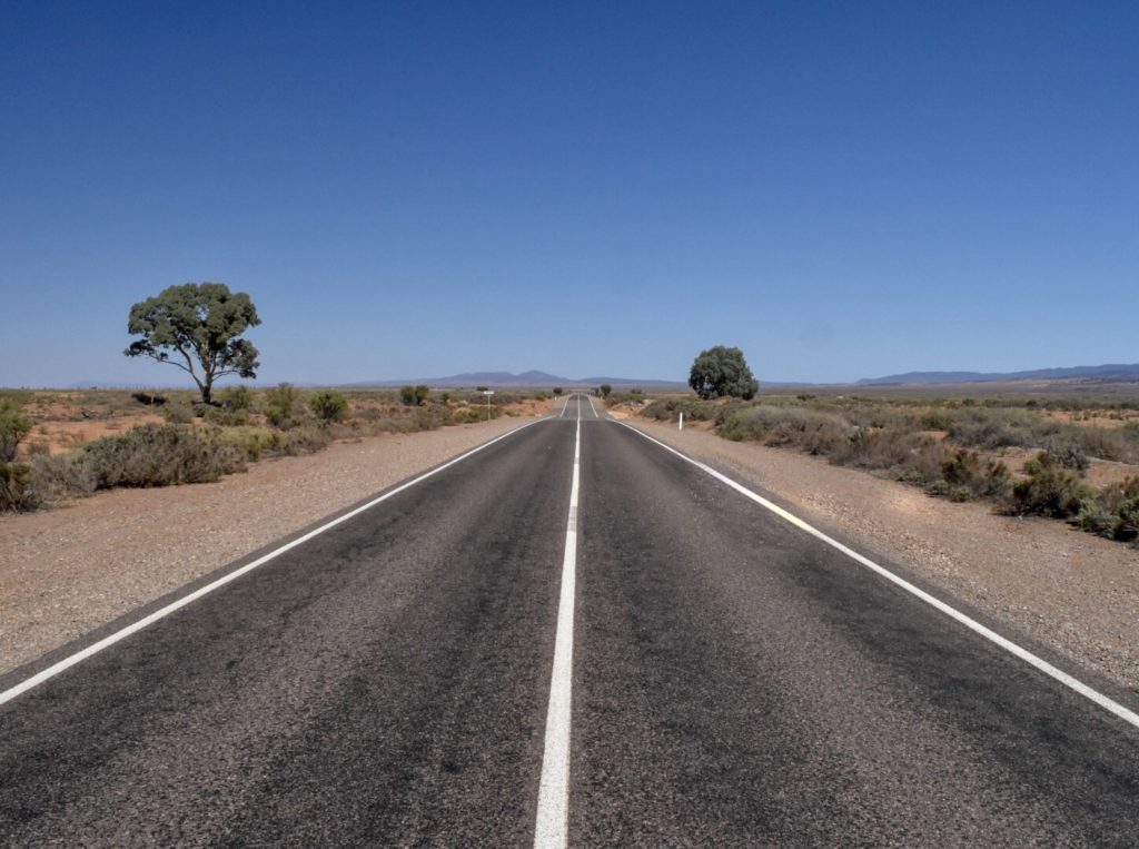
Living in cold, wet Melbourne for the past few years we had heard but didn’t truly appreciate just how drought-affected South Australia was. An Adelaide local had told us that many parts of South Australia had only received six millimeters of rain for the first quarter of the year, and here we were seeing the effects of that lack of rain with our own eyes. Skeletal-thin sheep stained red from the dirt desperately pecking at the ground for some hint of nutrients, numerous willy-willies dotting the horizon, thick clouds of dust kicked up by cattle as they trudged along…the evidence was everywhere. And that was just the beginning of it.
But firstly, we couldn’t drive through this region without a visit to the Prairie Hotel in Parachilna; it’s an institution in these parts.
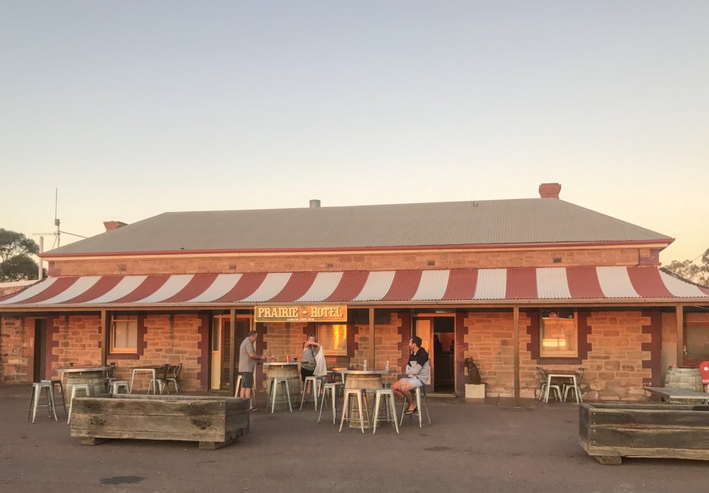
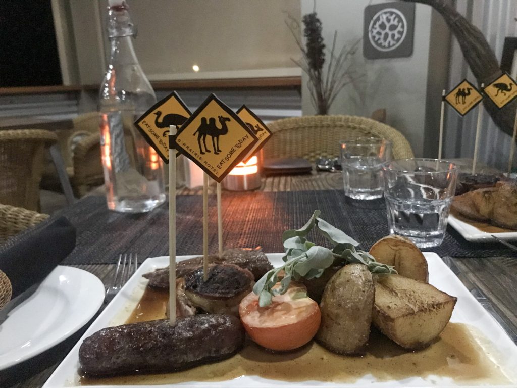
Owners Ross and Jane Fargher have done a great job with the place; you immediately feel welcome as you pull up a seat at the bar and get chatting to the friendly faces behind (which for us just happened to be Jane herself!) or around it. We also happened to be here to celebrate our third wedding anniversary; the previous two years we had celebrated at an upscale restaurant in Melbourne’s Southbank, and this year we were dining on a delectable assortment of kangaroo, emu, and camel known as a feral feast (don’t knock it ‘til you’ve tried it) and we loved it!
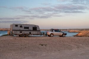
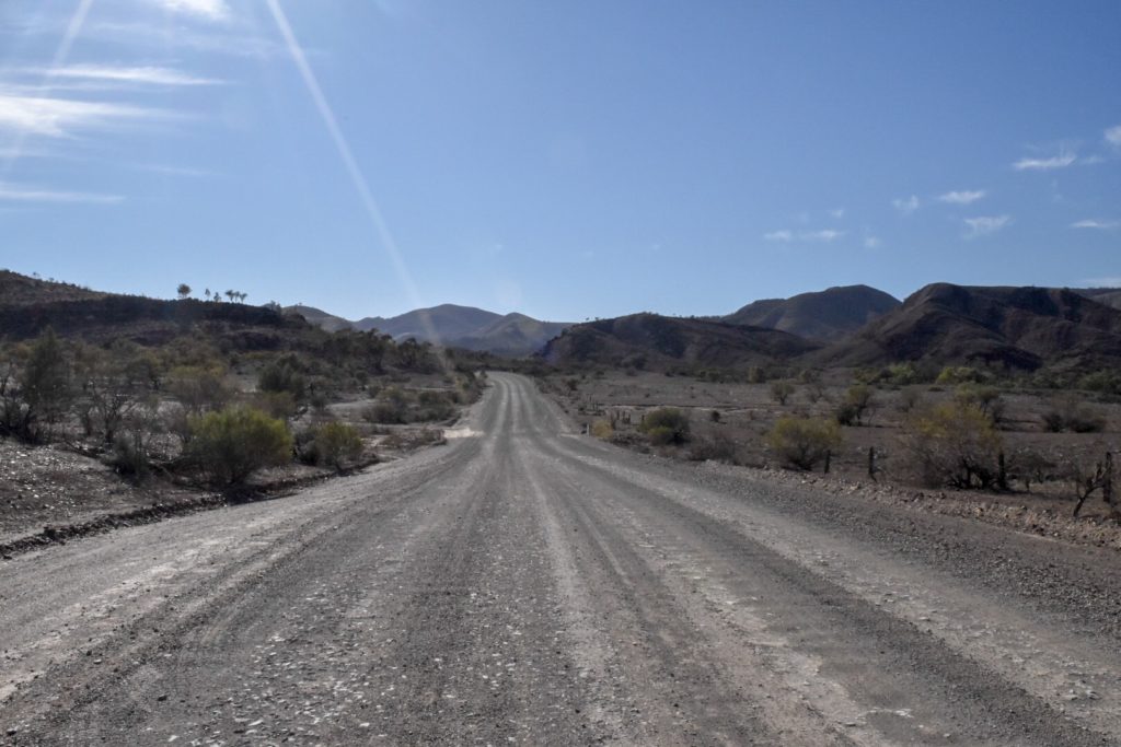
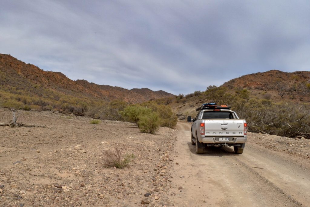
The next day we turned east off the Explorer’s Way from Parachilna onto the unsealed road, winding through Parachilna Gorge, stopping at Angorichina Village for last-minute supplies, then on to Chambers Gorge.
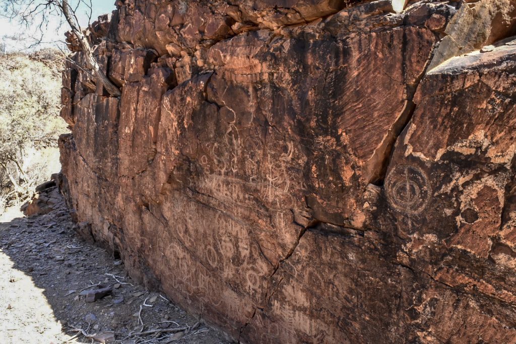
We had first heard of Chambers Gorge in an issue Pat Callinan’s 4X4 Adventures, where it was described as flourishing with vegetation, native animals every which way you looked. The Chambers Gorge we saw couldn’t be further opposite. Dry, dusty, devoid of life; that is, except for the trillions of flies that descended on us as soon as we exited the car. It just goes to show how many different faces this region has. Equiped with fly nets (which may look absolutely ridiculous yet make you so much more comfortable), a walk through the gorge led us to ancient Aboriginal drawings depicting initiation ceremonies. For the local Adnyamathanha people, this area holds a special significance.
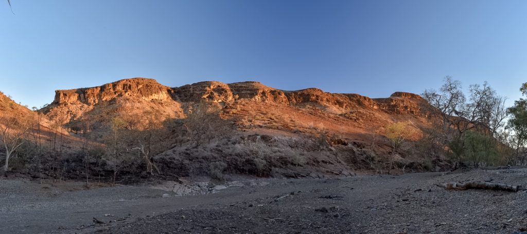
As the sun started to set and Chambers Gorge began to light up with a vibrant red, the beauty of the area really started to shine and proved that, even in the midst of a significant drought, it was still an awe-inspiring place.
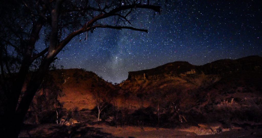
A walk up a nearby hill gave us a true appreciation of the vast isolation around us. The light of the sunset against the peaks lasted only briefly; a good reminder to be present in the current moment because they can be fleeting. But luckily for us, one moment of beauty was replaced by another as one by one, the stars, along with the bright streak of the Milky Way, lit up the night sky.
The next day we continued along the unsealed road north, watching in excitement as the dramatic ranges of the Gammon began to emerge before us.

Scoping out the various campgrounds upon arrival, we were thrilled to spot a yellow-footed rock wallaby, previously considered a rare and endangered species, perched on the creek bed rocks below Italowie Gorge camp.
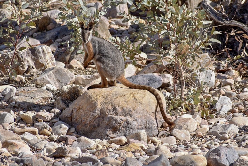
According to the rangers, the wallabies’ numbers are on the rise and sightings have become more commonplace thanks to initiatives such as Bounceback but also from the drought as they come closer to civilisation in search of food. We found more evidence of the drought further into the park as we noticed long expanses of barren trees that looked fire-stricken but, on closer inspection, were simply dried up from lack of water. This region had clearly not seen any significant rain in a long time.
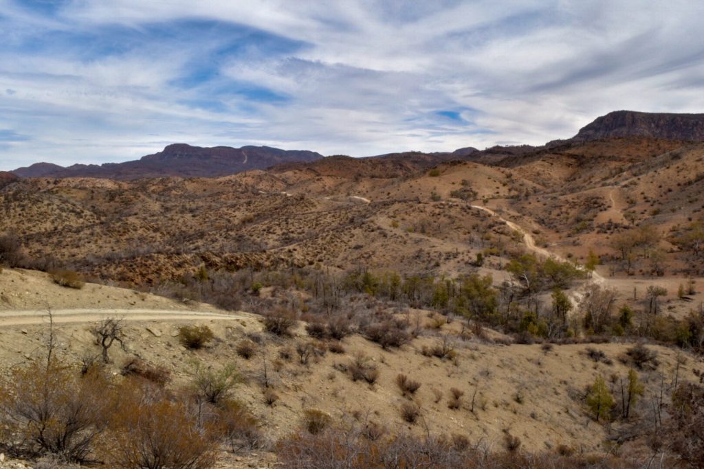
Our first 4X4 track to tackle was the Wortupa Loop in the heart of the Gammon. Access is via Mount McTaggart Track, a simple track that just needed to be taken slowly due to corrugations but also to properly appreciate the scenery around us.
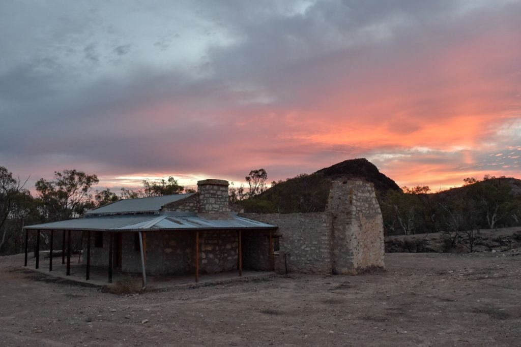
This track led to Grindells Hut, where the loop officially began. The first half of the loop was relatively uneventful, but once we reached Gammon Yards and started heading back, that’s where things got interesting. The track became much more technical, working our low range and downhill assist frequently throughout. One tricky downhill section even came complete with bull dust just to make it a bit more challenging, but with appropriate tyre pressure and taking it slow, it was a breeze.
Moreover, this section of the loop is one-way only, which took out the stress of consistently having to plan places to pull aside in case we came across a car coming the opposite direction.
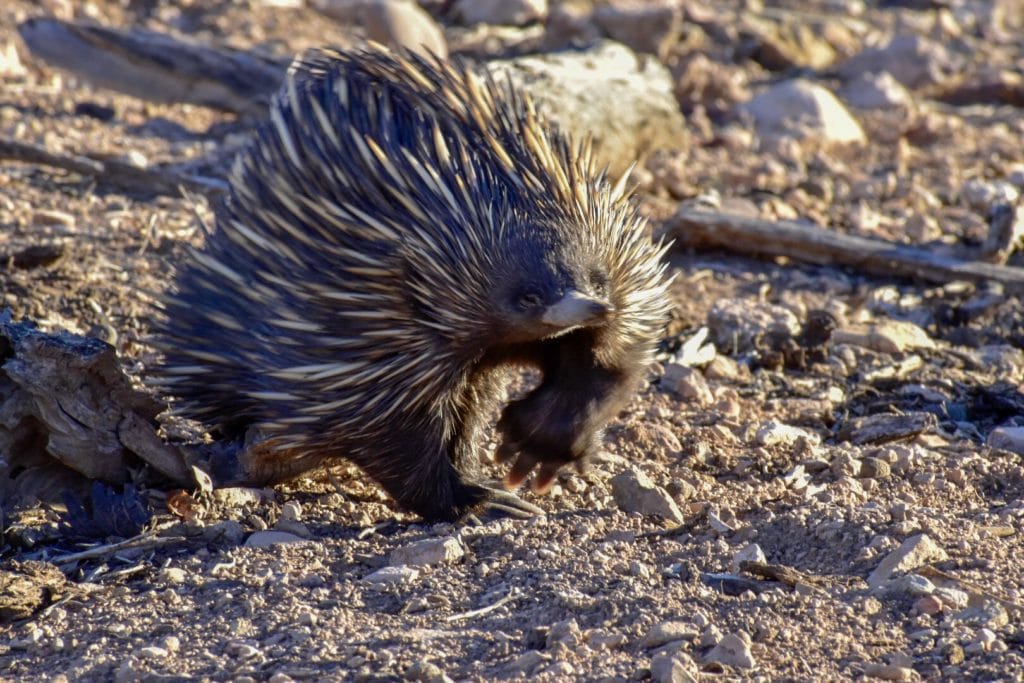
We were rewarded for our hard work with stunning views from Gills Lookout, before making our way back along Mount McTaggart Track and returning to camp in time to watch a determined echidna on his quest for food as the sky turned brilliant shades of pink and orange.
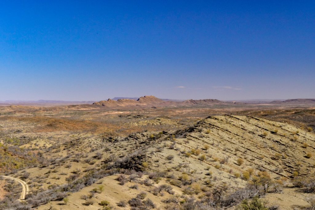
The following day we headed to Arkaroola Wilderness Sanctuary. The area has numerous bush walks and 4WD tracks available, which give you a true appreciation of the area, particularly geologically. We started off the morning in a more active manner with the 5.6 km Acacia Ridge walk, which has great outlooks over Arkaroola and beyond.

From there we jumped back in the Ranger and made our way from the village to Mt. Jacob backtrack.
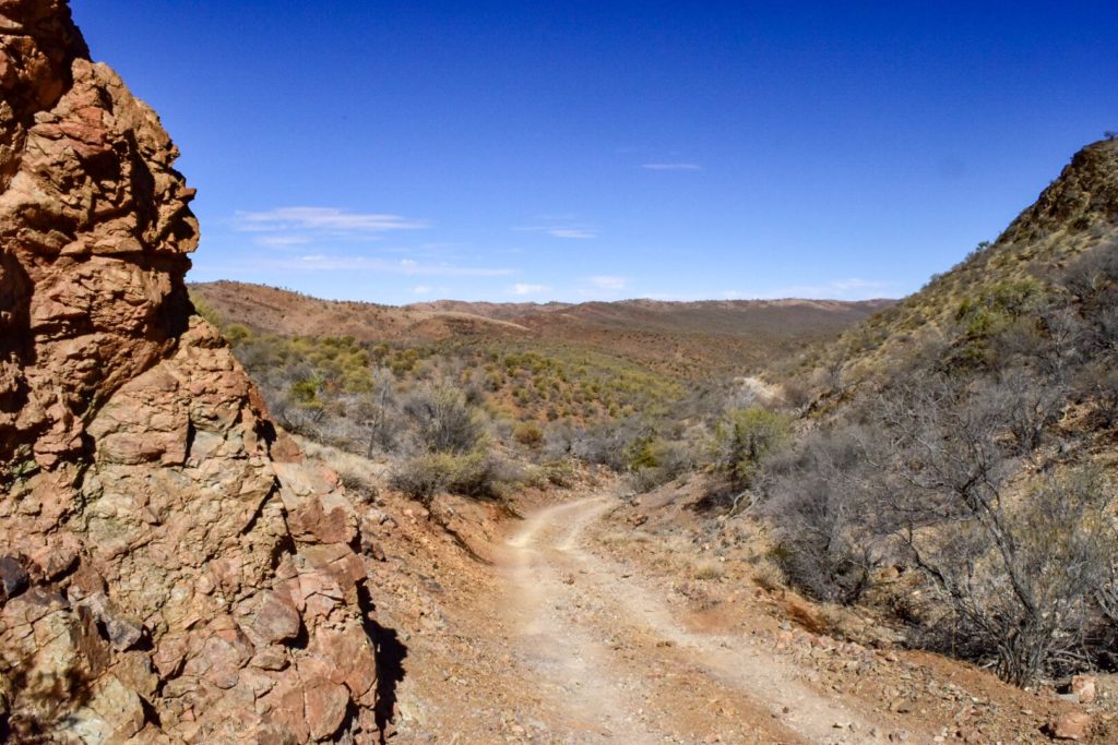
The map provided by Arkaroola specifies that Mt. Jacob Backtrack requires both a 4WD and 4WD experience, so from the outset you can be pretty sure you’re in for a good time. We thought the Wortupa loop was fun and scenic, but Mt. Jacob Backtrack was a whole new level. We would even go so far as to rate it one of the top 4WD tracks we’ve done in Australia up to this point in time. It is again a one-way track, so instead of worrying if someone’s coming around the bend on this narrow track, you’re wondering what breathtaking scenery you’re going to see next.
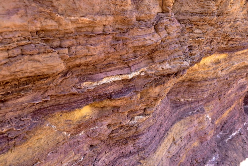
On the way to the track, we made sure to stop at the Ochre Wall; the colours in the ground and the wall were so vibrant they need to be seen to be believed.
The track comprised of a variety of terrains, from rocky creek beds to large dusty ruts, steep ascents and descents, complete with near constant anticipation of what’s around the corner. Each bend in the track seemed to come with another view that we just had to stop and appreciate.
Eventually finishing the track, we turned back onto the main road with that sense of exhilaration you only get after a 4WD experience that you know is going stick in your memory for good.
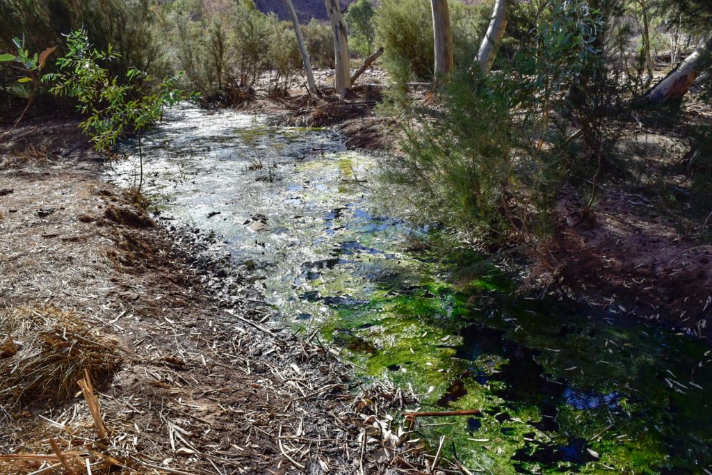
The next day, wanting to explore a bit more of Arkaroola, we returned for the Echo Camp Backtrack but firstly, we needed to top up our fuel. It was our first experience with having only one fuel station within over 100km of us. Now we’ve experienced price shock at the cost of fuel before, but nothing could prepare us for…$2.08 per litre. 😱 (the shocked emoji) doesn’t even begin to describe it, the pain of watching the dollars ticking over on the bowser far too quickly as we filled up. Nevertheless, it needed to be done if we were going to keep exploring this beautiful park. From there, we headed off on the self-guided drive. Equiped with a pamphlet which detailed meaningful points of interest along the route, we drove through the 37km drive, with a turn off along a rough track to Paralana Hot Springs, a radioactively-heated spring.
Back in the early 1900s, this used to be a popular spa destination until people learned what exactly was heating the springs and realised that radioactive material was not really something you wanted to be soaking yourself in. Luckily we didn’t see any roos with two heads or 3 eyes, but it was still pretty interesting spot nonetheless. Although we wouldn’t rate the track nearly as high as the Mt. Jacob Backtrack, we thoroughly enjoyed it.
When we weren’t having a blast exploring the countless tracks in Gammon Ranges and Arkaroola Sanctuary, we were working with the rangers at Balcanoona. So far it is the most fun we’ve had at a Parks SA volunteer placements. It was a really hands on placement where we learned lots of new skills, and the rangers were just awesome people to hang out with. Most of them had grown up in this region and had so much interesting insight on the area. These drought conditions we were seeing were nothing new to them; it’s all part of a regular cycle that the region experiences. Nevertheless, you could tell they were looking forward to the end of this extreme dry spell.
When we inevitably had to move on from the Gammon, we did so reluctantly. We left carrying a thick layer of red dust on the car but also a deep appreciation for the complex beauty of this region and just how tough and resilient this country can be.