As seen in Camper Australia
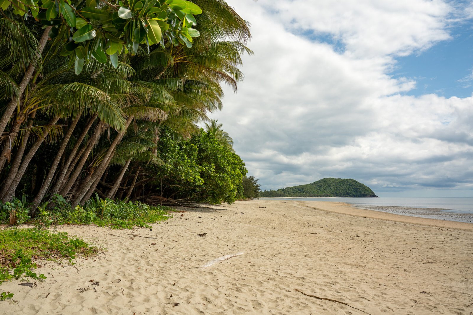
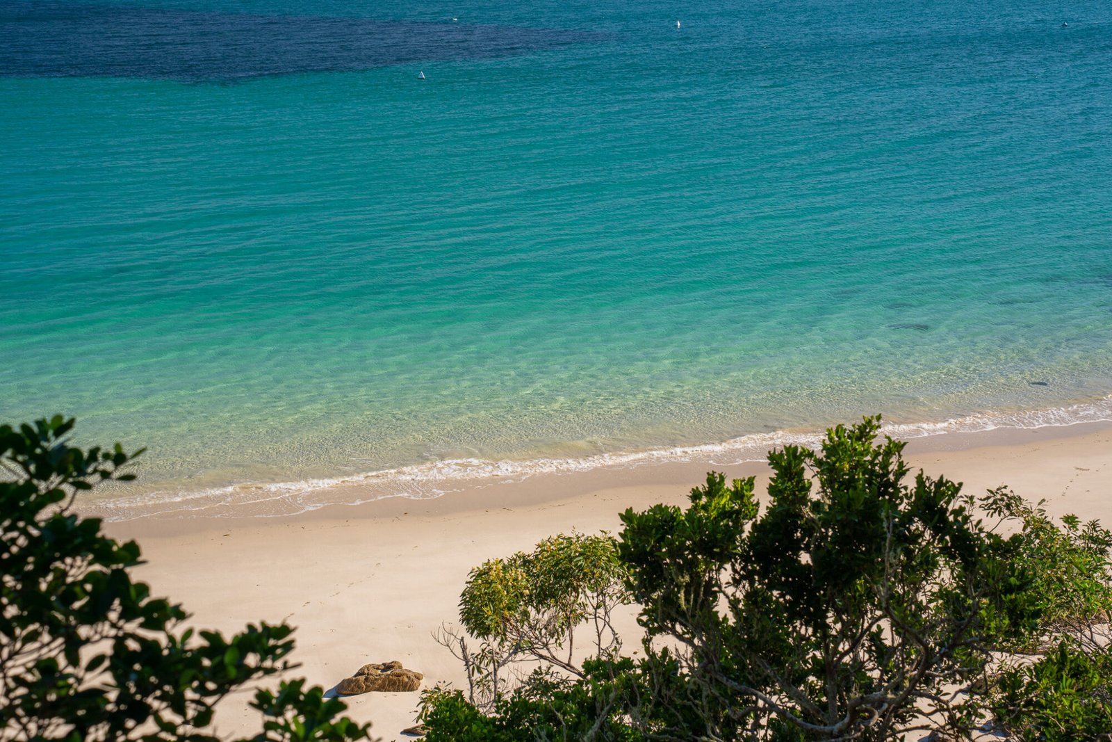
Welcome to the West Coast of Tasmania. It’s wild, with often wet and windy weather, winding roads, winsome towns, wonderful waterfalls, whimsical wildlife, and wow, is it beautiful! Most of the west coast’s climate results from being located between approximately 40 and 50 degrees latitude, in the middle of what’s known as the “Roaring 40’s.” The Roaring 40’s are characterised by strong westerly winds, which bring along with it cold and wet weather. On the upside, it also contributes to the unique ecosystems and biodiversity found in this part of the state.
THE RUGGED NORTHWEST
After coming off the ferry in Devonport, the most logical direction to head is north-west. Be sure not to miss all the delightful stops along the northwest coast, then stopping in at Smithton as a final stocking up point before continuing on to the Arthur-Pieman Conservation Area. For the avid meat-eater, head into a local butcher to pick up some Cape Grim beef — it’s a local delicacy. From Smithton, there are a couple options from which to base yourself to explore the area: for more amenities, the small town of Arthur River has a caravan park and several National Parks camps in its vicinity. If free camping is more your style, there is a fantastic self-contained camp located in Marrawah at Green Point Beach.

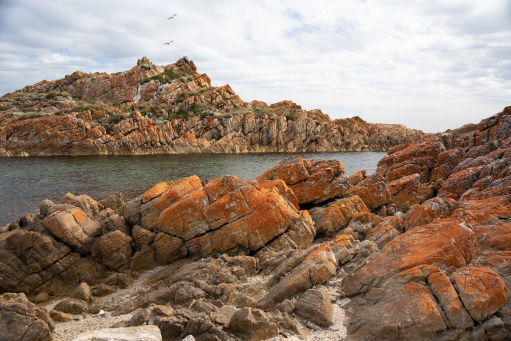
The points of interest in this region can be broken up into two sections: Arthur-Pieman Conservation Area and the Tarkine Scenic Drive. Both can be done as a large loop in a day but are best explored separately over a minimum of two days. The Arthur-Pieman Conservation Area showcases rugged coastlines, Indigenous heritage, and shack communities. After a quick stop at the Parks Office to pick up a parks pass if you haven’t already, cross the Arthur River bridge and make your way to the Edge of the World to see this wild coast up close.

Couta Rocks has some interesting ruins situated amongst the weathered fishing shacks still in use to this day. Other tracks off the main drive lead to various fishing communities and Indigenous cultural sites such as middens and rock carvings.

Continuing further south, there are plenty of four-wheel driving tracks, including one of the most notorious in all of Australia: the Balfour Track. Thanks to the Roaring 40’s and the wild weather it brings, this track is rarely ever dry and therefore extremely boggy; a winch and snorkel are required and travelling in convoy is highly recommended, bordering on necessary. If you’re keen to tackle the Balfour or any of the tracks in the area, you will require a recreational driver pass.
The other highlight of north-west Tasmania is the Tarkine Drive, located inland from the Arthur-Pieman Conservation Area. The Tarkine Wilderness Area covers an area almost twice the size of the ACT and is the second largest temperate rainforest in the world.

There are small campgrounds along the drive, but we recommend still basing yourself nearby and making this a day trip if towing a larger rig. Could you take a caravan down this drive? Probably. Are you going to enjoy it significantly more without towing? Definitely! Most stops along the drive are easily accessible and offer fantastic glimpses into this remote wilderness. Coming from Arthur River, Kanunnah Bridge makes a great photo stop before the road climbs to Sumac Lookout, which is an easy 5 minute return walk to a stunning lookout over the Tarkine.

The Julius River stop offers two enchanting rainforest walks, while the lookout at Dempster Plains showcases the buttongrass plains so iconic of this part of Tasmania. Depending on the time of year, Tayatea Bridge can be a good place to admire the smattering of colourful wildflowers.


Last but certainly not least is Trowutta Arch, a short rainforest walk which leads to a natural rock arch framing an intriguing green pool. If you have the time, there are plenty more stops along the way to explore.

HIDDEN GEMS ALONG THE WAY
To continue on to Zeehan and Strahan, it is highly advisable to backtrack via the main highways east towards Burnie before heading south if you are towing a larger caravan. While there are other roads that connect Arthur River to these southern towns, they are narrow and winding country roads that are not ideal for towing, and the journey includes a ferry that can only carry smaller rigs. Be sure to stop again at Smithton or Wynyard to restock; options for supplies become more limited once you continue on. While this leg of the trip can be done in a day, there are numerous stops along the way that are worth factoring into the itinerary.
Waratah is a delightful town approximately halfway between Wynyard and Zeehan. An impressive waterfall sits right in the middle of town, which includes an adventurous walk to some lower falls and an old hydro station (ask the locals for more information) as well as plenty of interesting history from the town’s proximity to what was once considered the world’s largest tin mine.

It is a great place to spot the elusive platypus in or around the town lake, particularly at dusk and dawn.

There’s also nearby Philosopher Falls, where an hours’ walk through the rainforest leads to an impressive waterfall gushing out from the lush vegetation. Moreover, Waratah can serve as a useful base to explore the Cradle Mountain region.

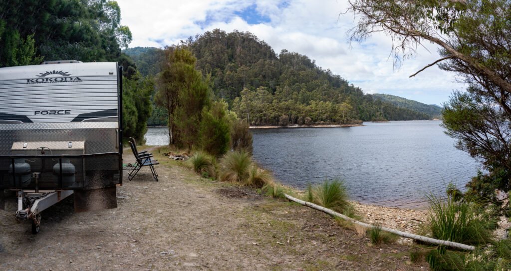
Another great stop along the drive to Zeehan is Lake Mackintosh, located 50 kilometres south of Waratah. Free camps abound in Tasmania, and this one is certainly a highlight; it features beautiful lakeside camping with great scenery and opportunities for fishing, kayaking, boating, or simply relaxing.
For the hiking enthusiast, there are several spectacular hikes in the area, such as Mount Murchison, the highest peak on the West Coast at 1275 metres. It is by no means an easy track and is absolutely not recommended to hike on a wet day; the track involves near continuous uphill climbs and some scrambling and rock climbing (no equipment necessary, though). It’s also not unusual to see snow here, even in the middle of summer! If the hike to the summit doesn’t leave you breathless, the views certainly will; prepare to be rewarded with 360-degree views of rocky peaks, glacial lakes, and man-made waterways as far as the eye can see.

TOWNS OF A BYGONE ERA
The next town from which to base yourself is the old pioneer town of Zeehan. Once a booming mining settlement that was the third largest town in Tasmania, Zeehan has become a bit of a relic of past days, and there is no better place to experience this town’s rich history than at the West Coast Heritage Centre. The centre includes four historical buildings: the post office, theatre, court, and school of mines, along with multiple other exhibitions.

Close to Zeehan is located the tallest waterfall in Tasmania: Montezuma Falls. This impressive 104m-tall waterfall is accessed from the north via a gravel road and 11km return walk along a former tramway, or from the south via a 4WD, dry-weather only track. Don’t miss an exciting trip out onto the suspension bridge!


Lastly, another fantastic day trip from Zeehan is to the tiny town of Corinna along the Pieman River. Coming south from Zeehan, you’ll need to take a ride on the charming “Fatman” Barge. Unless you plan to venture further than the township, you can leave your car on the opposite side of the river and cross as a pedestrian for a lower cost.

Camping is available here but only to those with smaller caravans as there is a length restriction for the barge. Once at Corinna, there are several activities to choose from. There are plenty of walks, from short strolls through the historic township, to several hours through pristine rainforest and Huon Pines. Exploring the Pieman River further is a must; this can be done either via kayak for a half or whole day, or aboard the historic ship Arcadia II. Otherwise, the delightful Tarkine Hotel is an ideal spot for a tasty pub meal and a yarn with fellow travellers.

Moving on from Zeehan is the lovely seaside town of Strahan, founded in the 1870s as a port access for the region’s mining settlements. For such a small town, there is an abundance of activities available. The most popular tours are the West Coast Wilderness Railway and a Gordon River Cruise.


We opted for the Gordon River Cruise but heard a lot of positive feedback about the railway trip, especially as a family-friendly activity. Day cruises usually set sail through Macquarie Harbour and include a visit to the rough seas aptly named “Hell’s Gates,” a serene voyage along the Gordon River and through World Heritage-listed forests, and last but certainly not least, a tour of Sarah Island, one of the most notorious penal settlements of Australia.

Top off the day by seeing the longest-running play in Australia, The Ship That Never Was. This interactive play, which has been running since January 1994, details the incredible —and true— story of the escape of four convicts from Sarah Island and is good fun for children and adults alike. Lastly, if you haven’t yet seen a platypus, Hogarth Falls can be a great place to see one as they are frequently spotted along the waterways here.

THE FINAL HURDLE
Hopefully by now you’re accustomed to Tasmania’s winding roads, because the next section of road is known as “The Road of 99 Bends;” this tortuous drive will definitely test your nerves! The trick is to take it slow, keep your eyes on the road ahead for oncoming traffic, and use your UHF to communicate as needed. Luckily there are several stops along the way to break up the journey.

The Iron Blow Lookout has great views over an old open-cut mine and informational signs regarding the fascinating and troubled history of the mining town of Queenstown.

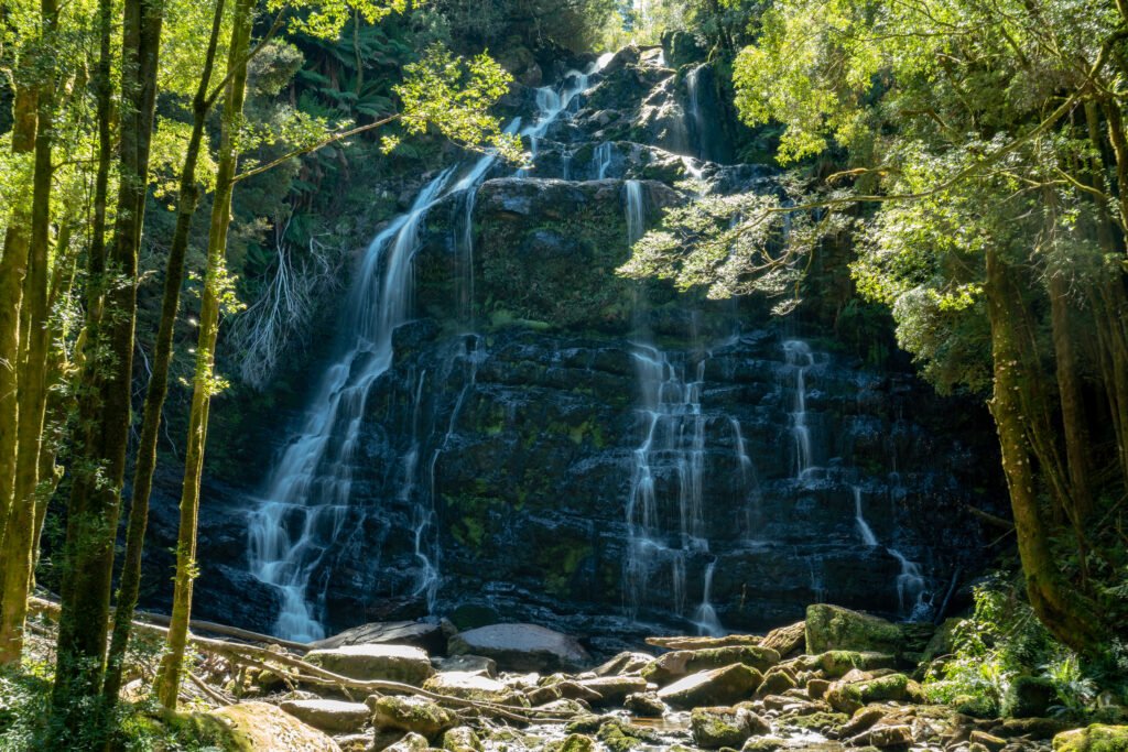
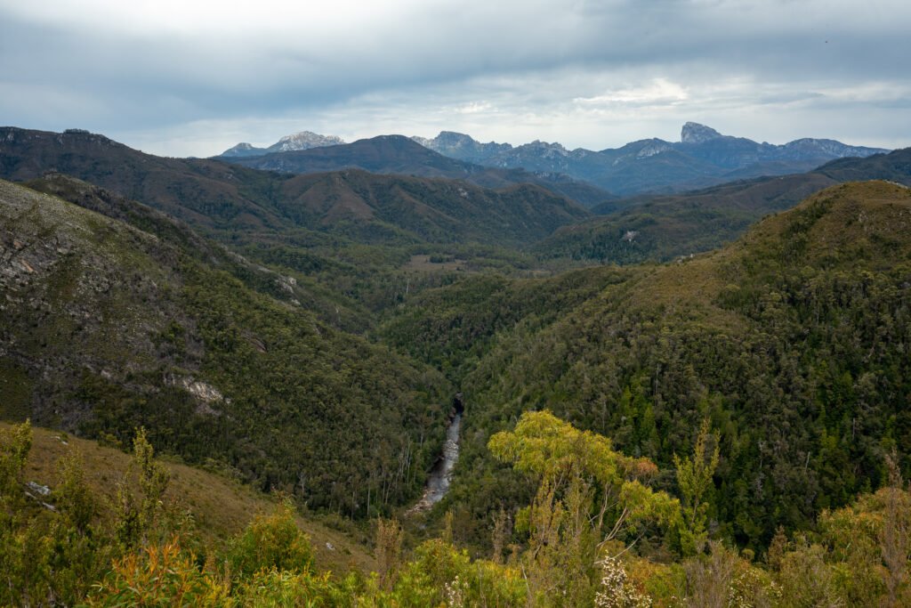
Nelson Falls offers a short, easy rainforest walk leading to an impressive tiered waterfall, and the Donaghys Hill track is a gradually inclined walk ending in impressive views.
The town of Derwent Bridge makes a great overnight stop, with a fantastic free camp at Lake King Williams. From here there are several options for continuing your journey; you can head north to Launceston, south to Hobart or wander through Tasmania’s Midland region.

Many visitors to Tasmania tend to leave the West Coast out of their itinerary, but in doing so, they miss out on a spectacular landscape not found anywhere else in Australia. If you’re looking for less crowds, remote and pristine scenery, fascinating history, and encounters with wildlife, the West Coast has all this to offer and much more.