After reluctantly leaving Esperance, we continued following the coastline west, stopping at the scenic beachside camps of Quagi Beach and Munglinup Beach, as well as a day trip through Stokes National Park, before heading towards what has become one of our favourite national parks of the trip so far.

In a remote, unassuming corner of coastline between Albany and Esperance lies a national park of international renown, Fitzgerald River National Park (FRNP). In 2017 it was deemed a UNESCO protected biosphere, owing to the fact that 15% of Western Australia’s plant species are found in the park, with approximately 75 species being found no where else on Earth. Additionally, it boasts the largest number of animal species of all parks in the south-west region of WA. Normally such ecologically significant places would be off-limits to visitors, and while the central portion of the park is fully closed for conservation purposes, the eastern and western parts are accessible to experience the unique flora, interesting geology, and beautiful coastline that this park has to offer.
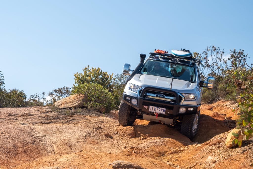
After a couple days in Hopetoun, which offers a great 48 hour free camp, stocking up on supplies and exploring the beautiful beaches along the Southern Ocean Drive, we entered the park along Hamersley Drive, the only sealed road in the park.

The other option for entry to the eastern side is from the north via the unsealed section of Hamersley Drive off the South Coast Highway, but the corrugations can be fairly brutal and we weren’t too keen on subjecting our van to that (again). We chose to set up camp at Hamersley Inlet, which is run by the Shire of Ravensthorpe and therefore a bit cheaper than the national parks camps.

There are numerous lookouts to choose from on this side of the park; Barrens Lookout is a quick and easy option to get some good views but for the more actively inclined, the climb up East Mount Barrens is a must do.

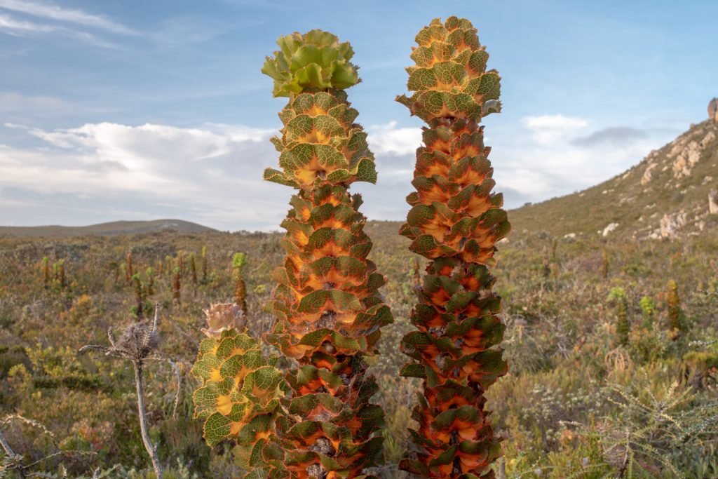
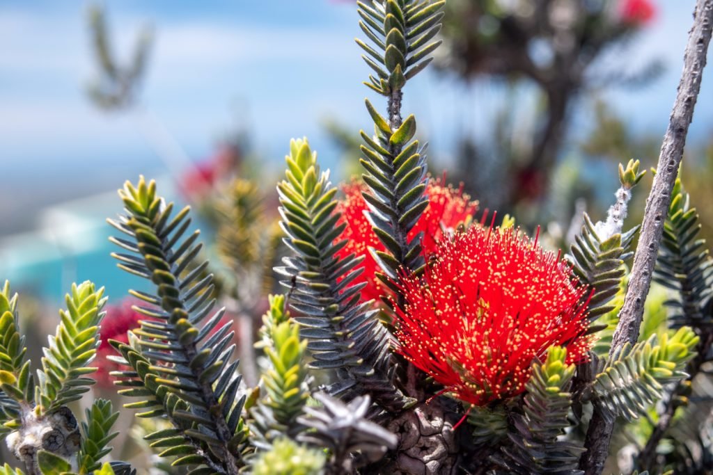
The path starts with a short boardwalk winding through some of the unique flora of the park, such as the Royal Hakea, which resembles a tall tower of stacked cabbages, and colourful bursts of wildflowers, including the Barrens regalia, which is found only in the immediate vicinity of East Mount Barrens.

Royal Hakea Barrens regalia
From here, it’s a sweat-inducing, scrabbly climb to the top, where you will likely see a few of the local Napoleon skinks scurrying about, and the jaw-dropping views from the top are more than worth the effort.

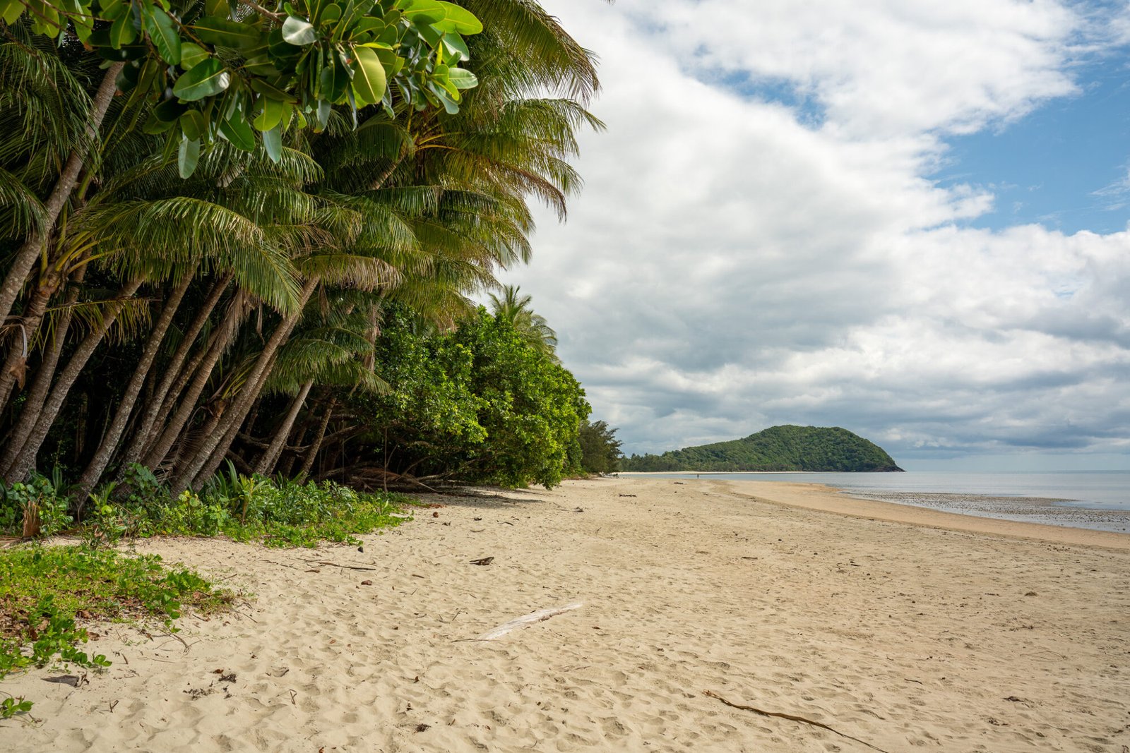
Barrens Beach and Four Mile Beach offer the best swimming and snorkeling opportunities on this side of the park.

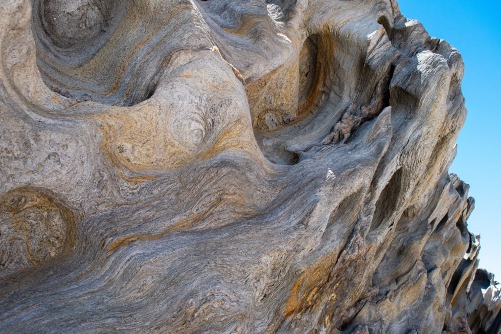
West Beach is a great spot to to see up close some of the unique geology of the Fitzgerald region, such as pelitic schist, which looks like it has glitter mixed through it, and folded rock with colourful bands.
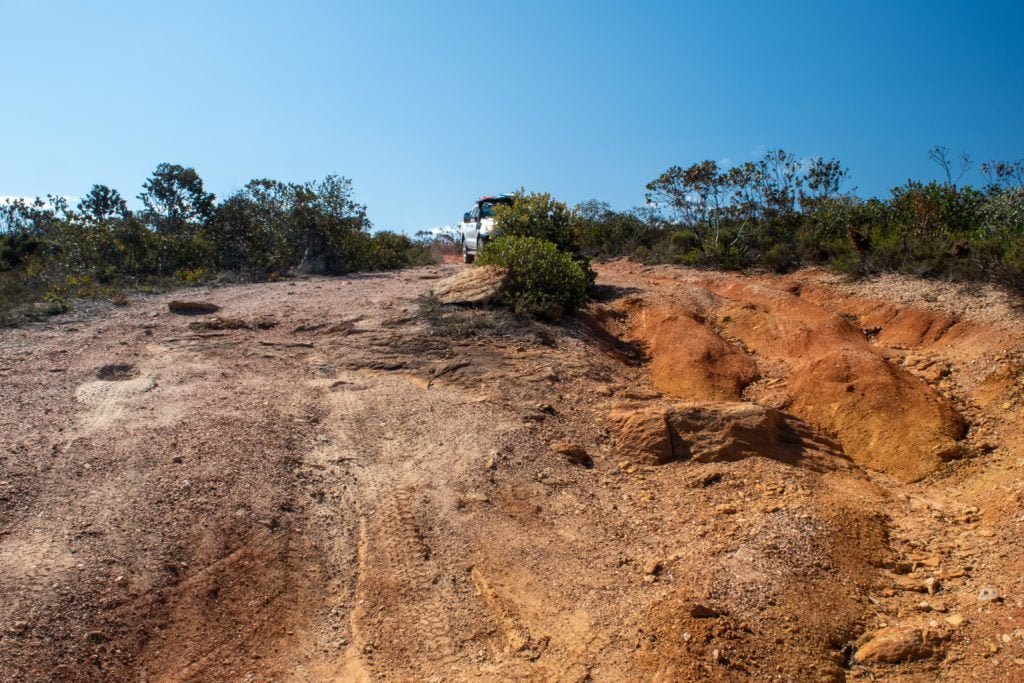
Continuing from East Mount Barrens north along Hamersley Drive, once we reached the unsealed road, it was approximately another 15km before the turnoff to Quoin Head Track on the left. As we headed further into the centre of the park, a set of peaks began to arise from the surrounding bush, part of the Barrens Range. The track stayed fairly easy, albeit a bit narrow, for a while until we reach a set of large washouts and the track began to earn its “4WD only” status.
Which side of the road would you pick? No surprise which one we chose!
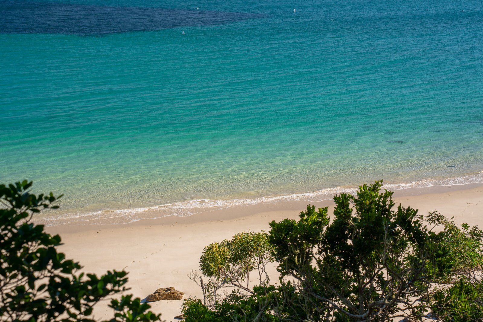
After getting through those, we were rewarded with the jaw-dropping beauty of the remote FRNP coastline: thick rolling bushland suddenly giving way to jagged, rocky cliffs dropping off to the clear, turquoise blue waters below. Up ahead loomed the unmissable Quoin Head, so named due to its shape resembling a quoin, or a wedge used on olden ships to raise or stabilise the cannons.

The track wound back and down steeply along the gravel road, which required care to control the decent, especially with our all-terrain tyres being on their last leg, before finishing at a day use area overlooking a pristine white sand beach with the “quoin” towering in the background.

There were other 4WD tracks that are available to explore more of the eastern section of the park, such as a track off Quoin Head Track that leads to the picturesque Hamersley Beach and dunes, but they were extremely narrow and scratchy and, we decided, not worth the damage to our beloved Tex. So instead we cruised back to climb East Mount Barrens again to enjoy a cracking sunset to cap off a great day.

Once we had our fill of the eastern end of FRNP, it was time to check out the western side, which involved a bit of a detour since there is no access through the central section of the park. So we headed west on the South Coast Highway, turning south at the town of Jerramungup, then east towards Quaalup Homestead where we would set up whilst exploring west FRNP. That afternoon we paid a visit to Twertup, where you can walk amongst ancient and colourful spongolite, a type of sedimentary rock almost entirely made up of the “skeletons” of sea sponges from when an inland sea existed.

The next day we packed up our hiking packs and set off to tackle the Mamang Walk, a 31km return overnight walk from Point Ann to Fitzgerald Inlet. After checking out the lookout points along Point Ann, which provided great views over Point Charles Bay, we set off east along St Mary’s Beach before turning inland towards Lake Nameless, a large inland salt lake.

The lookouts provided a good opportunity to rest and admire the terrain, but hands down the best views were at Point Charles Lookout, which can be reached from Point Ann as a full day hike. From here we looked out over Fitzgerald Beach, with the most intensely turquoise water we had yet to see, with the Barrens Ranges as a backdrop.

From here it was a short walk to the campsite, which left much to be desired in regards to general upkeep, but we were able to find a nice flat spot to set up our tent which was really all that mattered to our weary bodies.
The next day we completed the walk almost entirely along the beach, at one point being kept company by a pod of dolphins and, after a quick dip to refresh, back to our van in Quaalup. After a good night’s rest, we packed up and made our way to Bremer Bay, which has a multitude of beautiful beaches to choose from. Our favourites were Little Boat Harbour Beach for snorkelling and Native Dog Beach (be aware of strong currents though!). Unfortunately we were too early for killer whale season, which is around March-April, when these beautiful creatures are commonly seen in the waters around Bremer Bay.

Our next adventures were going to take us inland for the first time since we got to WA: the Stirling Ranges and Porongurup National Parks!